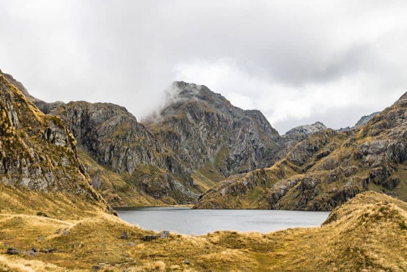
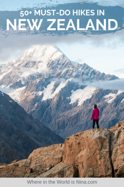
50+ of the Best Hikes in New Zealand & Hiking Tips
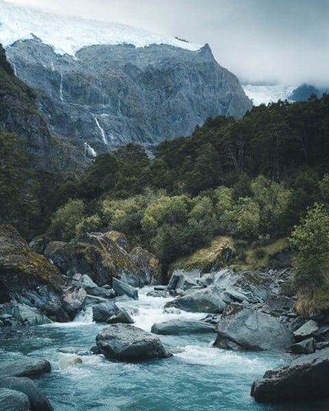
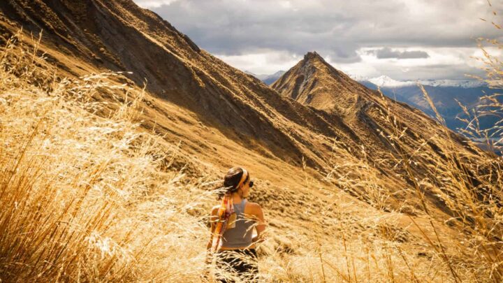
Glistening glaciers on top of mountain peaks, milky turquoise lakes, and golden tussocks wavering in the wind. This is what I think about when I think back on my nearly five months in New Zealand.
I came with little plans but ended up getting really hooked on hiking in New Zealand.
Turns out, if you’re after the best way to see a country’s jawdropping landscape, then getting outside and tramping through the bushes and over the mountain tops is probably the best way to do it! Revolutionary information, right?
Aside from wanting to be in the outdoors and enjoy hiking, if you want to keep to a budget in New Zealand, hiking will be your new best friend because it’s mostly free all around the country. Nearly every other activity can get quite pricy.
So hiking in New Zealand became my life for the first half of 2019 and I can confidently say, there are no regrets! My booty got a workout and I got to experience New Zealand in the best way possible, by getting up high and wandering through forests.
I assume you’re here to do the same so let’s get into it…
Table of Contents
- Best Hikes in New Zealand
- North Island Hikes in New Zealand
- South Island Hikes in New Zealand
- 10. Queen Charlotte Track
- 11. Abel Tasman
- 12. Mount Arthur (Kahurangi National Park)
- 13. Mount Robert Circuit
- 14. Pancake Rocks
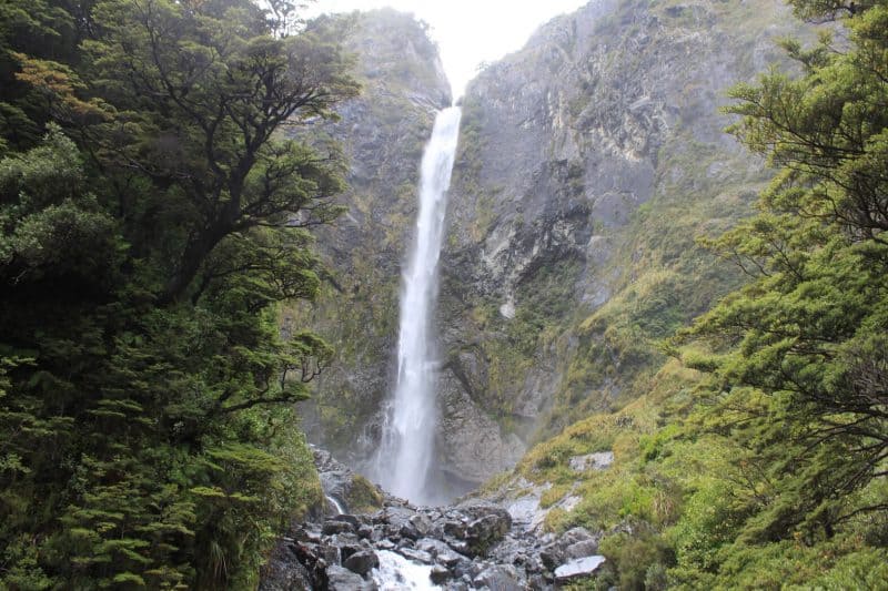
- 15. Temple Basin – Arthur’s Pass
- 16. Foggy Peak Hike
- 17. Cave Stream Hike
- 18. Kura-Tawhiti Track to Castle Hill
- 19. Devils Punchbowl Walking Track
- 20. Hinewai Waterfall Loop
- 21. Onawe Track
- 22. Godley Head Walk, Canterbury
- 23. White Bluffs Peninsula Walk
- 24. Mount John Trail
- 25. Kea Point Hike
- 26. Red Tarns Hike / Continue to Mount Sebastopol
- 27. Hooker Valley Track
- 28. Tasman Lake & Blue Pools Hike
- 29. Sealy Tarns Hike / Continue to Mueller Hut
- 30. Fox Glacier
- 31. The Copland Track
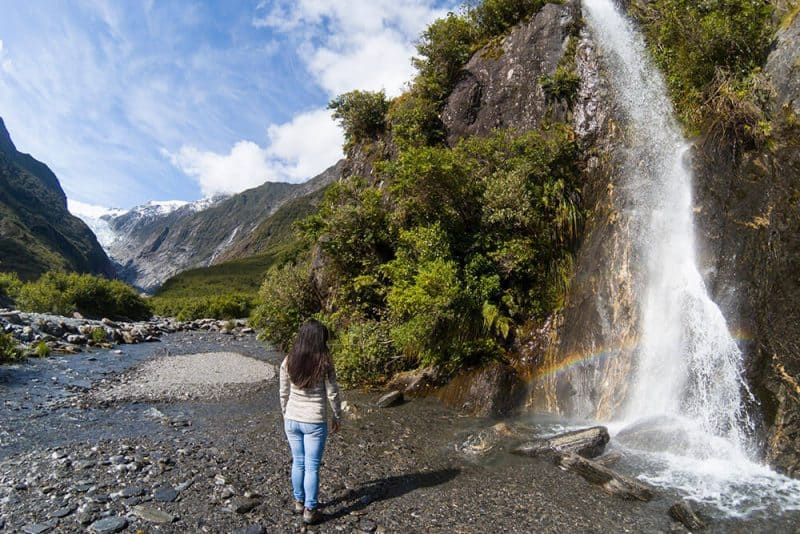
- 32. Franz Josef Glacier Track
- 33. Brewster Hut
- 34. Roy’s Peak
- 35. Isthumus Peak
- 36. French Ridge
- 37. Rob Roy Glacier Track
- 38. Diamond Lake Track
- 39. Grandview Creek Trail
- 40. Routeburn
- 41. Jack’s Point
- 42. Kepler Track
- 43. Tunnel Beach Track
- 44. The Sandymount Track
- 45. Harbour Cone Track
- 46. Nichols Falls
- 47. Waipohatu Trail
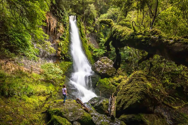
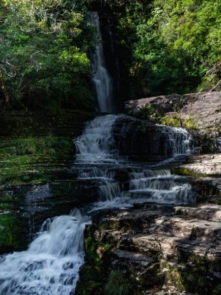
- 48. Koropuku Falls
- 49. Mclean Falls
- 50. Cathedral Caves
- 51. Rakiura Track, Stewart Island
- Tips for Hiking in New Zealand
- More New Zealand Hikes
- A Guide to Hiking The Kepler Track in Fiordland National Park, New Zealand
- 5 Epic Hikes in Mount Cook National Park That Are TOTALLY Worth It (New Zealand)
- Guide to the Routeburn Track: Should You Do It as a Day Hike? (New Zealand)
- Hiking Roy's Peak & How to NOT to Wait in Line For A Pic (New Zealand)
- A Guide to Hiking the Mueller Hut Track & What to Pack (New Zealand)
Best Hikes in New Zealand
Here’s a list of pretty much every single hike in New Zealand that I did.
But I’m an overachiever and also, just one person, so I asked some of my blogger friends to add some of their favorite hikes from New Zealand too! So this list should keep you quite busy.
On top of that, the majority of the hikes on this list have helpful links for you to get even more information on the hike and the area too, so feel free to click around on your favorite hikes!
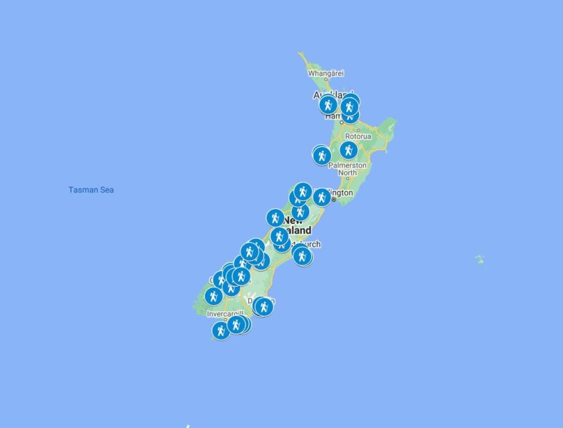
The hikes are separated by North Island and South Island. I sort of listed them from north to south the best I could. Since there are so many, I also made you a handy dandy map to help locate where the hikes are for all my people who like map visuals like me.
Lastly, grab a snack or something because speaking of hiking over mountain tops and through forests, this post is packed with over 9,000 words of information on hiking in New Zealand, which is quite a feat in itself.
The following New Zealand hikes are all listed with roundtrip distances and the difficult rating was standardized using alltrails.com, however, there is some personal experience sprinkled in to give you a better idea of the hike as well.
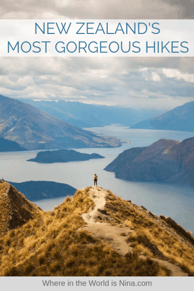
Don’t lose this! Click the picture to pin this for later.
North Island Hikes in New Zealand
1. Waitakere Ranges
- Distance: 3.5km and under
- Difficulty: All are easy
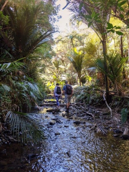
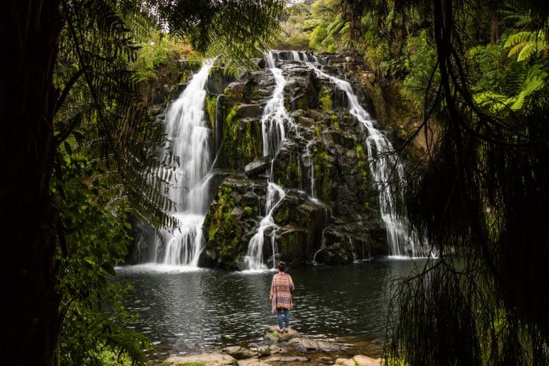
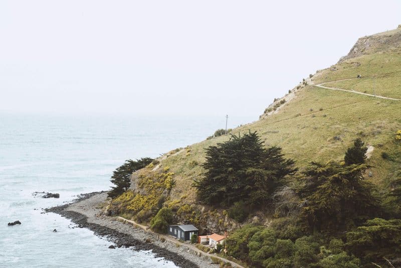
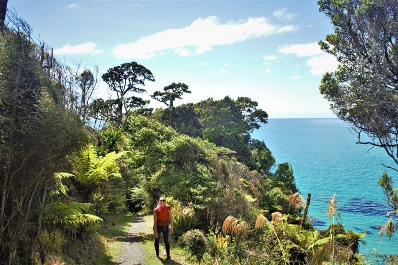
Immerse yourself in the great outdoors while hiking in New Zealand with a visit to the Waitakere Ranges and Piha Beach. Located on New Zealand’s north island, this stunning hike will take you along the beautiful cliffside trail of Mercer Bay track (2.7km) which is studded with viewpoints out onto the raging ocean.
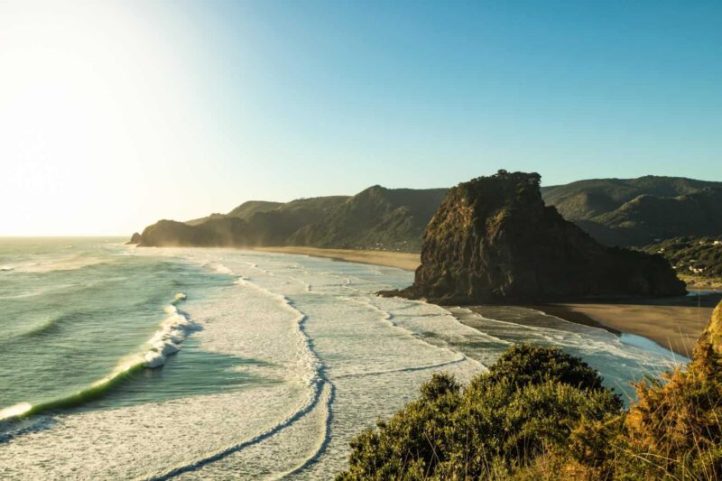
Lion Rock (.5km) rises majestically out of the water, with views that make the steep climb to the top worth it or take a look at Lion Rock from a distance from the Tasman Lookout Trail (1.1km) at the south end of Piha Beach. There are some great waterfalls in the area, including the Karekare Falls (.8km) which tumbles 30 meters from a cliff and Kitekite Falls (3.5km), a multitiered waterfall, both of which are easy to reach and worth the short hike to reach them.
Related: Piha & Waitakere Ranges Walks, Waterfalls, and Beaches
2. Goldie Bush Walkway
Recommended by Sarah from Exploring Kiwis
- Distance: 6km
- Difficulty: Moderate
Located on the outskirts of Auckland, you’ll find the unique Goldie Bush Walkway and Mokoroa Stream Track with a dozen or so river crossings, we’ve never encountered a day hike that’s so close to a major center while offering such excitement–it’s a definite Auckland must-do.
The hike begins with a 2.7km track, weaving its way downhill, through beautiful native New Zealand bush From there, it connects to the highlight of the walk, the Mokoroa Stream Track (3km). With countless stream crossings, stunning water holes and the opportunity for a little free-climbing (should you choose), this hike is a real treat!
Once you’ve enjoyed a delicious picnic lunch in front of the Mokoroa Falls, head on up the Mokoroa Falls Track (1.5km) – the home straight back to your car.
The Goldie Bush Walkway is well off the tourist trail but all the same is an incredibly worthwhile and uniquely Kiwi hike.
With so many water crossings and muddy spots, be sure to take along a good pair of boots (or at the very least, some old running shoes as they will get dirty) As this hike is a fair way out of the city, you’ll definitely need your own transport. We’d generally recommend a rental car to allow you to see all of the sights at your own pace.
3. Cathedral Cove
- Distance: 3.2 km
- Difficulty: Easy
When in the Coromandel, you can’t leave without a visit to Cathedral Cove, a unique cave opening which leads to a beautiful beach.
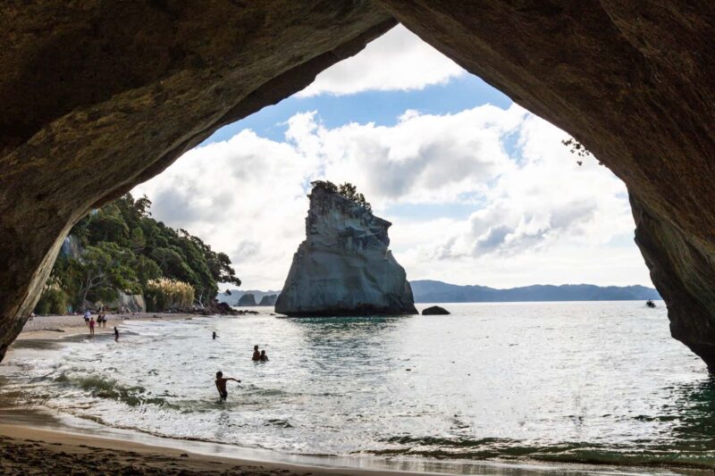
It is a pretty steep trail but one you arrive it is clear why it is one of the most visited attractions on North Island. There are a few more coves worth visiting along the way too. Before going, be sure to read these tips for hiking at Cathedral Cove.
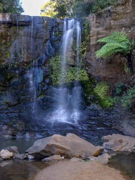
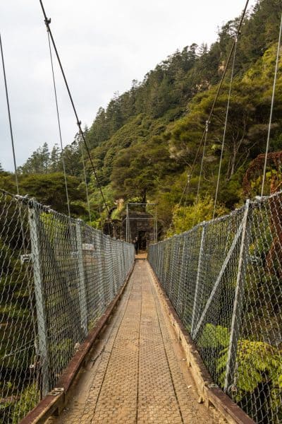
4. The Karangahake Gorge Historic Walkway
- Distance: Under 3km
- Difficulty: Easy
The Karangahake Gorge Historic Walkway offers a few different hikes such as The Windows (1.8km), which has some beautiful views down over the gorge.

While in the area be sure to take the 20-minute Kaiate Falls Walk (.8km), a very worthwhile waterfall to visit as well as the two-minute walk to Owharoa Falls which is a gorgeous mossy cascading waterfall just off the main road.
5. Pinnacles Walk Coromandel
Recommended by Alex from Weekend Kiwis
- Distance: 16km
- Difficulty: Hard
On the lesser-known side of the Coromandel Peninsula, only about a two-hour drive from Auckland, lies a place that will make you feel lightyears away from civilization. The parking lot at the end of Kauaeranga Valley Road marks the start of the Pinnacles Walk.
The hike takes about 8 hours to complete and will properly work out your legs and glutes
In the beginning, it’s a mostly flat gravel path that leads along the Kauaeranga River. Soon the path starts climbing. First, it will take you over an old landslide and later up many, many steps
In fact, the steps have been carved into the rocks by Kauri tree loggers in 1920s. The steps made it easier for their packhorses to climb the steep paths to the bushmen’s camp.
Before the final climb to the Pinnacles summit, you can rest your aching legs at the Pinnacles DOC hut.

The hut accommodates up to 80 people and is the biggest DOC hut in New Zealand, with a ranger living there permanently. If you prefer, you can break up your hike and make it a two-day walk. If you do, please be aware that even though it’s a huge hut, it often sells out over the weekends and needs to be pre-booked. You will also need to take your own bedding and cooking utensils with you. There are a BBQ and gas cookers available for your convenience.
The final ascent to the summit is more challenging but also a lot of fun. Firstly, there are some more stairs before you start climbing metal ladders and hooks that are attached to the rocks. It can be challenging, but it’s absolutely worth it.
The view from the summit will blow you away!
For your hard work, you are rewarded with an almost 360° view over the Coromandel Peninsula that will make you feel like you are on top of the world!
One last tip for the ones staying overnight: It’s especially amazing on top of the Pinnacles during sunrise and sunset.
6. Wentworth Valley Waterfall
- Distance: 3km
- Difficulty: Easy
There are some stunning things to see in the Coromandel area of New Zealand, where waterfalls, pristine beaches and incredible views are in abundance.
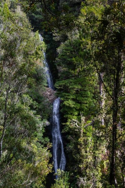

A cool hike in New Zealand is the Wentworth Valley Waterfall Hike which will take you through lush jungle to Wentworth Falls, a two-tier cascade which will have you reaching for your camera. Take the small detour to the right of the viewing platform to get to the base of the falls.
If you’re campervanning the country, this hike’s trailhead starts from a DOC campsite. It is down a dirt road for a few kilometers but can be done by any vehicle.
7. Wilkies Pools & Dawson Falls
- Distance: 4.5km
- Difficulty: Moderate
These two are in the same area and can be done in a loop. This is a quick trail and a great intro to the Mount Egmont National Park, featuring Mount Taranaki. Dawson Falls is beautiful and the enchanted trails make for a gorgeous backdrop.

The area can get a bit muddy and if you plan on doing some of the detours, check with DOC first. I wanted to do a few of the detour but was told not to due to extremely muddy conditions in very steep areas. The Wilkies Pools and Dawson Falls are a safe bet usually as they are easily accessible but the detours get messy, literally!
8. Poukai Circuit
- Distance: 24.5km
- Difficulty: Hard
Hiking the incredible Pouakai Circuit is one of the best ways to experience the incredible Mount Taranaki in Egmont National Park. Covering a distance of 25km it is a varied trail covering boardwalk, forested areas, wooden steps and lots of mud, all of which help to make it one of the best hikes in New Zealand.
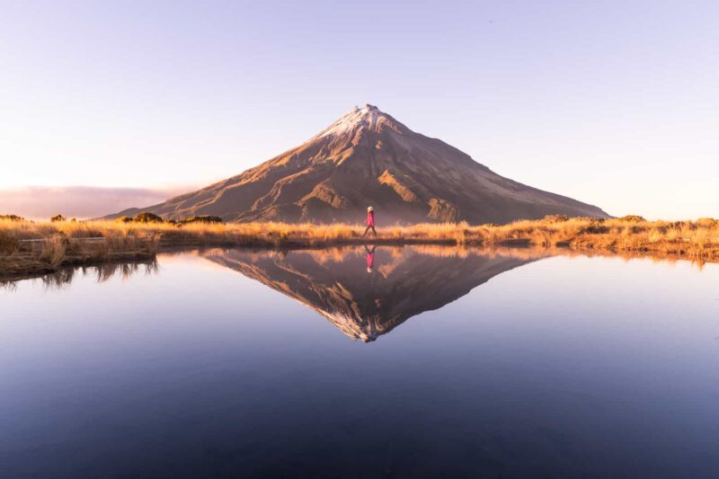
Walking around the mountain will give you an incredible perspective of this natural wonder, with one of the most incredible sights being the perfect reflection of Mount Taranaki in the tarn in front of it.
Overall this trail ventures through some of the most beautiful areas of Egmont National Park, perfect for adventurers looking to experience the rainforest, alpine swamp, tussock highlands, and magical volcanic features. On the trip, don’t miss out on the slight detour that will take you up to the mighty Bell Falls to see the water cascade over the ancient lava flow.
To complete this circuit, you’ll need to stay at the Pouaki Hut just 20-30 minutes away from the tarn. Catching sunset and sunrise at the tarn is a must but you won’t be there alone.
9. The Tongariro Alpine Crossing
Recommended by Nicky from Go Live Young
- Distance: 19.5km
- Difficulty: Hard
The Tongariro Alpine Crossing is a 19.5-kilometer hike through the volcanic heartland of New Zealand’s North Island. A world-renowned trek, it is often described as the “world’s greatest day walk”.
The trek takes you through a remarkable volcanic landscape, with crazy rock formations, moonscape vistas, mighty volcanoes, beautiful colored lakes and steaming cracks in the earth. The views are spectacular throughout.
This is a point to point hike, so transport arrangements must be made for both ends of the hike. Transport can be arranged from the local village. This is a challenging hike with a grading of difficult.
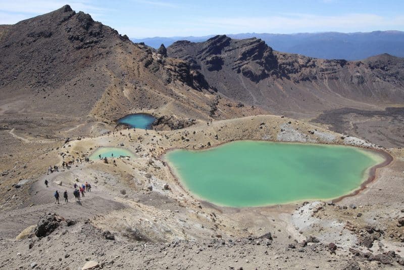
This challenging New Zealand hike climbs the Mangatepoppo Valley to the saddle between Mount Tongariro and Mount Ngauruhoe (famously known as Mount Doom in the Lord of the Rings Trilogy) through the South Crater, before climbing again to the Red Crater, the highest point on the crossing (1886 meters). At this high point on the trek, you have tremendous views in every direction of the Tongariro National Park.
You then descend on volcanic scree to the Emerald Lakes. This section of the hike is steep and slippery and some may need hiking poles. From here it is onto the Blue Lake. The track then follows the northern slopes of Tongariro, before zig-zagging all the way down the mountainside.
The descent is long and tiring. This day hike will, however, provide some of the most spectacular volcanic scenery you’re ever likely to see!
The Tongariro Crossing takes between six to eight hours to complete. All food and drink must be carried on the hike, as well as essentials for changing weather conditions. The Tongariro Alpine Crossing can be subject to unpredictable weather and can be closed to hikers.
Click the picture to pin this for later!

RELATED: Your Guide to the Tongariro Alpine Crossing in New Zealand.
South Island Hikes in New Zealand
10. Queen Charlotte Track
- Distance: 63.4km*
- Difficulty: Moderate*
The Marlborough Sounds are STUNNING and the Queen Charlotte Track runs right through it. Since this is a private track, the trail requires you to purchase a day pass.
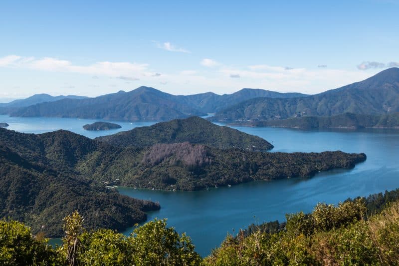
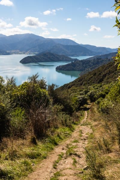
There are tons of trails in the area but the Queen Charlotte Track is the most popular and main trail. It takes days to complete but as with most hikes in New Zealand, you can hop on some of the trails just for the day. The Onahau Lookout and the little bays in between provide some great views and are towards the beginning of the trail if you just want to pop in for a day as we did.
*As mentioned, you don’t have to do the whole thing, you can just do a portion.
11. Abel Tasman
- Distance: 54.4*
- Difficulty: Hard*
The Abel Tasman walk is a multi-day Great Walk Hike however, we decided to make our lives easier and leave tons of money in our wallet by doing two separate day hikes.
Marahau to Anchorage is an easy hike for the day, however, it’s long. We did all the detours on the hike, enjoyed the beaches, and had a picnic. The 25 kilometers was a lot but again, the trail was easy. It took us pretty much all day with plenty of time to chill.
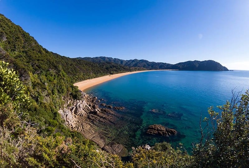
Our next day we started at the Totaranui Campsite and headed to Separation Point. The beach after the Anapai Campsite was my favorite! This day was a bit easier with around 14 kilometers under the belt but again, the trail is pretty easy.
*This is only if you do the ENTIRE thing, you can do what I explained above and just hike small sections of it.
12. Mount Arthur (Kahurangi National Park)
Recommended by Yen from Swing Abroad
- Distance: 16.9km
- Difficulty: Hard
Mount Arthur is always one of the most underrated hikes in the northern part of South Island. Due to its remote location in Kahurangi National Park, the trail takes a detour of more than an hour for those who’re doing road trips in New Zealand South Island.
It has also been living under the shadow of Abel Tasman and Nelson Lakes National Park located beside it. But today, we’re going to shine some spotlight onto this amazing trail.
The hike starts at Flora Car Park, an hour drive from Nelson city. The hike takes 2 hours or more depending on your stamina and the weather, to get to the summit. It takes an hour to get from the parking lot to the hut.
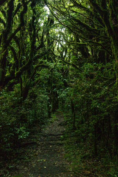
On your way to the hut, you’ll be surrounded by dense forest. Therefore, keep your jackets in your bag as you’ll most likely be sweating due to the lack of wind.
But after the hut, most of the trail will be walking on the ridge. You’ll be amazed by the astounding views throughout the entire hike, but be careful if you’re hiking in the autumn or winter. Ice forms easily on the ridge, and it’s easy to slip down the steep slope.
I should also mention that after the hut, the wind will be extremely strong. So keep your body low when you’re walking on tight ridges.
The final stage before reaching the summit requires you to climb up a huge ice boulder. It’ll be a challenge for those who don’t have trekking poles or something that can hook the ice block. If you’re not confident, don’t force that, because the boulder is located close to the steep slope.
The views are great even if you don’t reach the summit, where you can enjoy a panoramic view of the entire national park.
Psst… Fun fact, Mount Arthur is also a popular spot for kiwi bird spotting. Spend a night at the hut, and see what you can get!
13. Mount Robert Circuit
Recommended by Sarah from ASocialNomad
- Distance: 8km
- Difficulty: Hard
The Mount Robert Circuit is located on New Zealand’s South Island within Nelson Lakes National Park The route is well signed and easy. While the circuit itself is just 8 kilometers, you can extend it and tramp along the Angelus Hut tracks.
This area is well served by DOC campsites, the Angelus Hut and the Bushline Hut – which has great kitchen facilities, fresh water, heating and 14 bunks available There’s no booking available here, it’s first come first served.
There’s a great hike up to the Bushline Hut on Paddy’s Track – but this route is pretty exposed, so only attempt this section with good clear weather, and wear lots of sunscreen too! You’ll get amazing views of the beautiful Lake Rotoiti.
The route returns via the Pinchgut Track, which zigzags down through woods. DOC states that the route should take 5 hours in total, but most will complete it in around half this time.
En route, you’ll be able to see the historic Kea Hut, built by skiers in 1931 – it’s not possible to go inside, but it makes a great photo opportunity!
14. Pancake Rocks
Recommended by Tayler from Traveling Tayler
- Distance: 1.1km
- Difficulty: Easy
During my time in New Zealand, I was really fortunate to be able to extensively explore the South Island. One of my surprising favorites was the Punakaiki Pancake Rocks and Blowholes Walk located in Paparoa National Park. Situated a short 40-minute drive from the town of Greymouth, the rocks are beautifully situated along the Tasman Sea coastline
The walk is a 1.1km loop starting a short distance from the parking lot. Although there are a few sets of stairs, it is a mostly flat and walkable path with multiple viewing points to see the different natural formations
First, you will walk straight into what is called the “pancake” rocks. They are made of limestone and after 30 million years of weathering, they look a bit like stacks of pancakes! It’s quite the geological oddity.
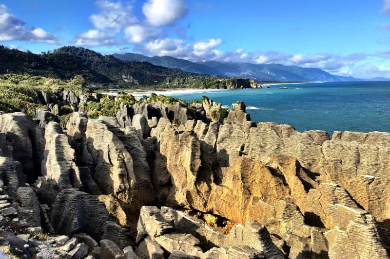
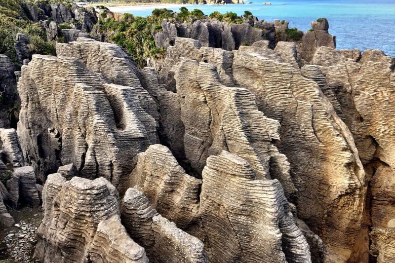
Through and around the rocks you will get to watch the naturally formed blowholes and be able to stop and gaze out over the sea. If you’re lucky you might even catch some dolphins! The end of the loop takes you through a rich green coastal forest before ending back at the street. In total, I probably spent about 45 minutes on the walk as there were so many unique and interesting things to see.
After your walk, you can pop into the cafe for a meal or coffee and exchange a book at the community book exchange refrigerator. It’s a quaint area with not much else to explore nearby, but if you find yourself on the West Coast you won’t regret visiting.
15. Temple Basin – Arthur’s Pass
Recommended by Camille from Crafty Explorer
- Distance: 4.3km
- Difficulty: Moderate
Located in the Arthur’s Pass National Park, Temple Basin is one of the most scenic trails in the area.
The track zig-zags up the hill to the Temple Basin Ski Club, which is very popular in winter. In fact, Temple Basin features outstanding mountain views, a ski lodge, and a beautiful waterfall.
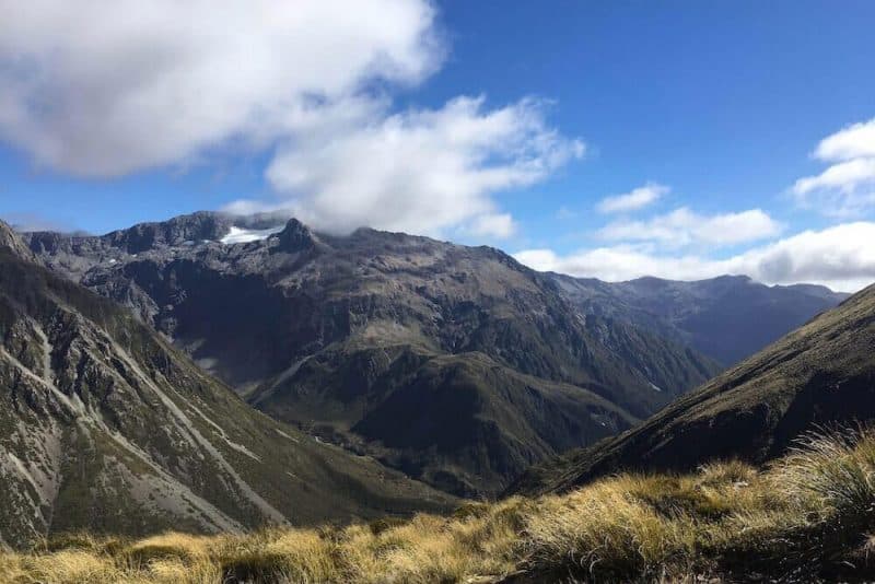
Allow a good 3 hours return to walk this trail. It’s a steady climb from the beginning, and it is definitely not an easy walk to get to the top of Temple Basin, but it is well worth it. On top of that, you will be walking on stones most of the way. So, you will need to wear good hiking shoes to do this track.
When you get to the top, you will be rewarded with spectacular 360-degree views of Mount Rolleston across the valley, and you’ll be able to enjoy the peace and quiet of the area. This 4.3 kilometers track is often described as a nature photographer’s dream, so don’t forget to bring your camera. You won’t be disappointed.
16. Foggy Peak Hike
- Distance: 5km
- Difficulty: Difficult
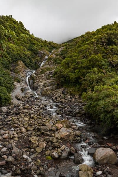
The Foggy Peak hike along Arthur’s Pass gives you exactly what you’d expect, fog! It’s incredibly trippy and definitely adds to the challenge of this hike. It’s a straight-up hike that gets quite steep in some spots and the loose ground leaves you scrambling without getting anywhere at some points.
The top offers up some decent views of the surroundings, and if you’re lucky, a crazy foggy spectacle like we encountered. The fog covered just one side of the mountain creating an epic illusion of sorts. Be careful as the possibility of losing the trail becomes great when the fog disperses leaving you in a thick grey blanket without any trail markers!
Definitely follow an offline map when this happens so you don’t wander too close to an edge or something on accident.
17. Cave Stream Hike
- Distance: 1km
- Difficulty: Easy
Ideal for those up for a bit of a challenge, the Cave Stream Hike at Arthurs Pass is pretty incredible but is one of the harder hikes in New Zealand as you will be in the water for most of it. Be prepared for this hike, as soon as you enter the cave the water is up to your chest.
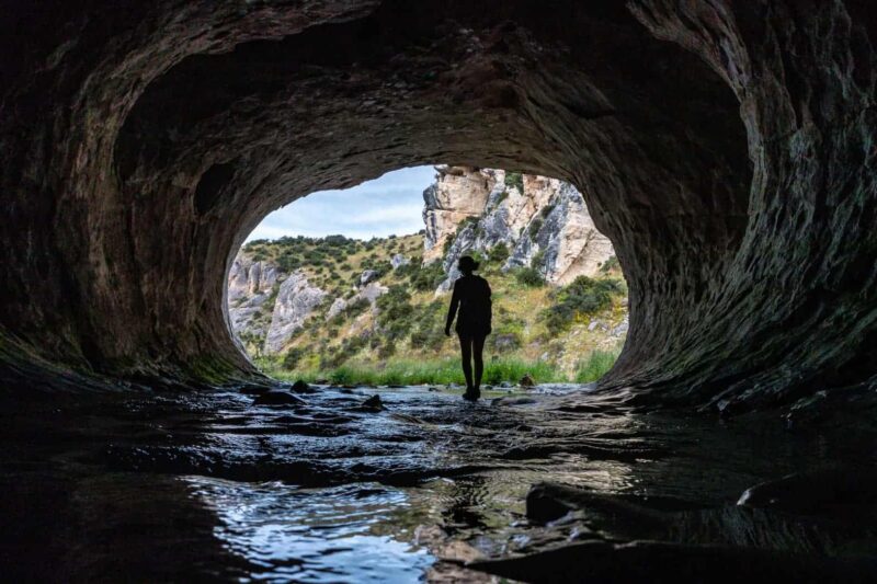
For the rest of the walk the water should be up to your knees as you go against the stream, around boulders and even up small waterfalls. It is beautiful and exciting but can be pretty scary, so it’s maybe not the best idea to tackle it by yourself. The hike ends in a raging waterfall.
It will definitely give you an adrenaline rush, just be sure to take proper precautions as it can be challenging. Read all about hiking the Cave Stream before going.
18. Kura-Tawhiti Track to Castle Hill
- Distance: 5.3km
- Difficulty: Moderate
This is almost not really a hike, it’s more like a maze to wander around! The Castle Hill hike in New Zealand is super popular for appearing in films like The Chronicles of Narnia: The Lion, the Witch and the Wardrobe and you can totally see why. It literally looks like Narnia… because it is.
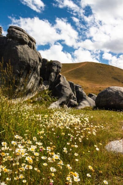
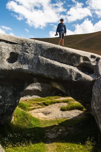
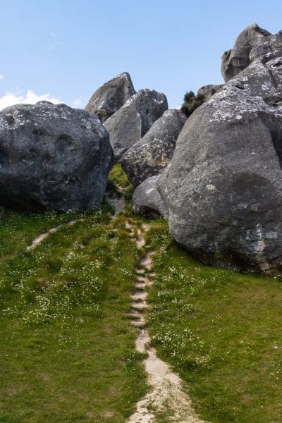
The most bizarre boulders and rock formation are here for you to trek around without a real trail or “way” to go. Just get lost in it.
19. Devils Punchbowl Walking Track
Recommended by Suzy from Suzy Stories
- Distance: 1.8km
- Difficulty: Moderate
The track to the Devils Punchbowl Waterfall is easily one of the best short walks in Arthur’s Pass and a popular hike in New Zealand. Although it’s only a short track, the route is packed with gorgeous surroundings and a variety of views the whole way. Listening to the not-so-distant sound of keas chirping away, you’ll start by crossing two footbridges over the Bealey River and Devils Punchbowl Creek. Already you’ll gain impressive views through the pass and a sneak peek at the waterfall awaiting you.
The track quickly gains elevation, albeit not high, but the steps make the 150m incline that bit more challenging. Through thick forest, you’ll be well sheltered from any rain along the track, but at each corner keep an eye out for the snow-capped peaks emerging through the clouds. Do note that when visiting in the warmer seasons you’ll likely come across a range of pesky bugs ready to bite. So be sure to cover up or arm yourselves with bug spray.
You’ll soon hear the thunderous sound of water getting closer as the track evens out. Pause at the final corners if you can’t wait until the lookout, but the real magic is being faced with the mighty waterfall up close. You won’t regret the effort of the steps once you reach the end!
What makes the walk so special is the essence of great New Zealand nature in one neat track. Crashing waterfalls and mountain views right alongside a luscious forest and the chance to even see a great spotted kiwi at twilight makes it a short but sweet adventure to enjoy without the hours of walking.
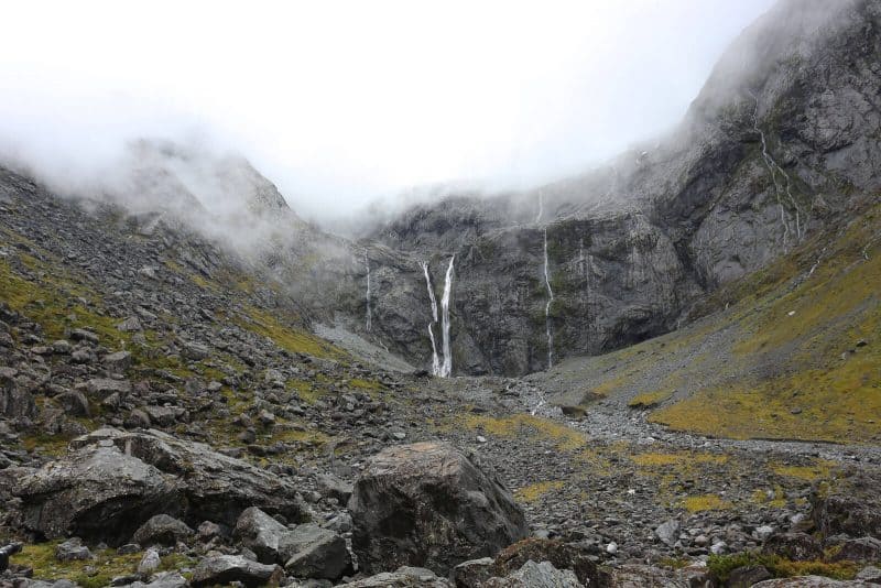
20. Hinewai Waterfall Loop
- Distance: 3.7 km
- Difficulty: Moderate
I loved this little loop because there were four small waterfalls, good views, and zero people on the trail! Park your car here and take the easy waterfall loop to Fushia, Boundary, Hinewai, and Ghost Falls.
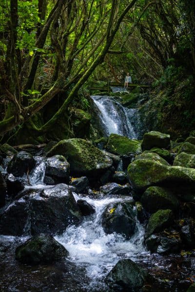
The last one was the most fun and the most adventurous to get to as you have to play limbo under some fallen trees to get there.
There are a few lookouts along the way too. The trail is shaded half of the time and sometimes has you going through some tall brush. There’s a small hut along the way that has water and a restroom. There will be a few river crossings on this hike as well so wear proper shoes.
21. Onawe Track
- Distance: 2.4km
- Difficulty: Easy
Just down the way from Hinewai, is the sacred Maori site, Onawe. There’s a short hike around the peninsula giving you the best views of Akaroa Harbour.
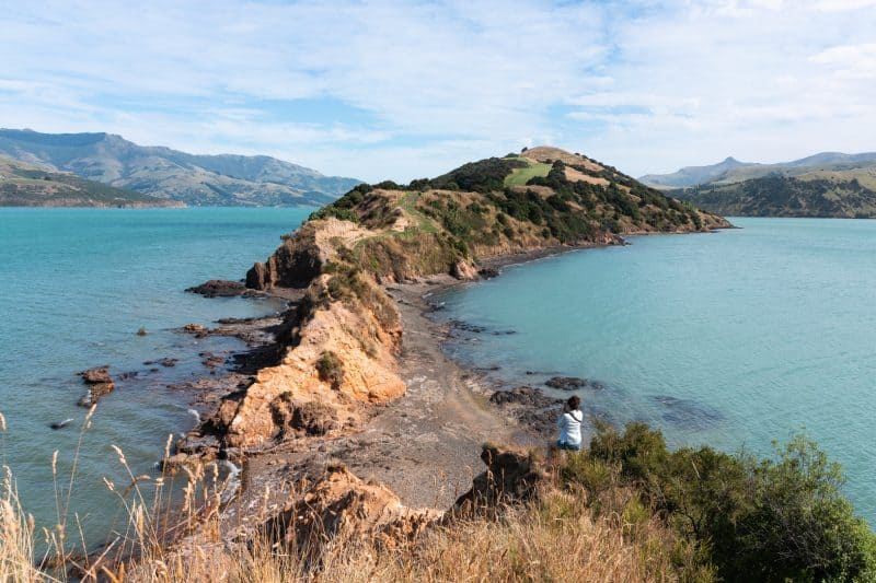
The beginning of the hike can be sketchy along the ridgeline but that’s what made it fun. You can take a little detour along the beach if you want to avoid this spot. Take a loop at the end of the peninsula for some more views and head back to hang at the beach for a bit.
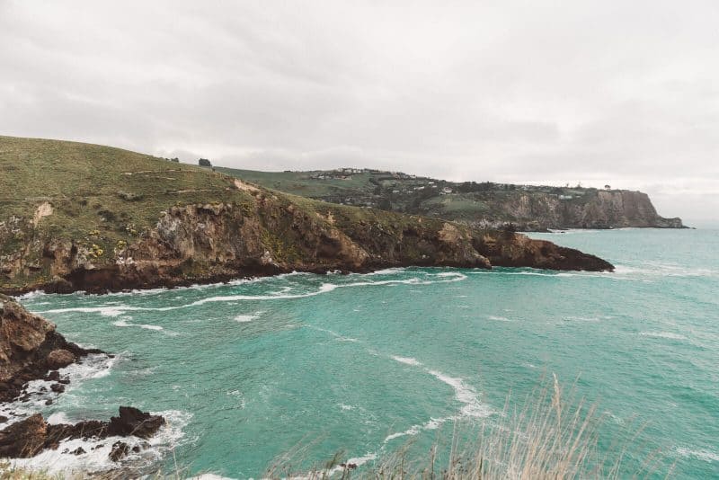
22. Godley Head Walk, Canterbury
Recommended by Nadine from Le Long Weekend
- Distance: 13.5km
- Difficulty: Moderate
The Godley Head walk is an incredible coastal track near Christchurch City in New Zealand’s South Island.
The 13.5km track can be followed from the southern end of Sumner Beach, however, most walkers park at Taylors Mistake beach, which shortens the walk to around 8km.
Listed as a moderate level track, the slightly undulating walk is relatively easy with only a few steep sections.
The track takes you around the craggy headland and offers spectacular views over the ocean. Its remote and privileged position means it’s also a brilliant place to spot birdlife and if you’re super lucky you may even be rewarded with a white-flippered penguin sighting!
These petite penguins are endemic to the Canterbury region and nest in the nooks and crannies along the coast.
But birdlife isn’t the only highlight; keep your eyes on the ocean for dolphins and seals, and on the track for a stray sheep—as the path cuts right through an active farm.
Other attractions on the looped track help keep it interesting and varied. You can take the short detour to Boulders Beach with its traditional beach huts, or to the historic Scott’s Cabin, which, rather incredibly, has voyaged all the way to Antarctica and back before being relocated to its scenic resting place.
There are also several remnants from WW2, as well as various caves to explore and conveniently placed benches to pause and enjoy the views
Leave early to enjoy the calm part of the day, and allow time to fully immerse yourself in this special corner of Canterbury.
23. White Bluffs Peninsula Walk
- Distance: 5.3km
- Difficulty: Easy
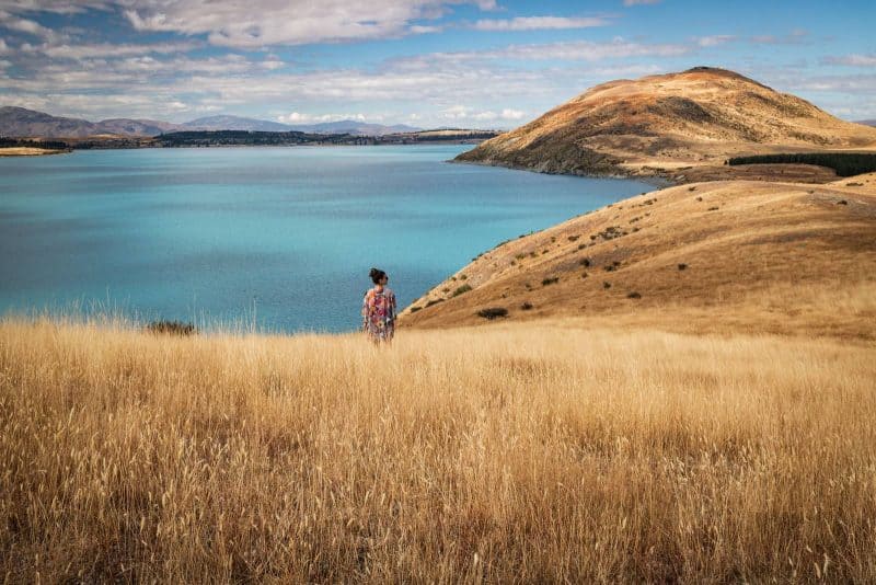
As much as the water of Lake Tekapo is beautiful and easy to see from a parking lot, there are a few incredible hikes in the area that provide a better vista, such as the Peninsula Walk. This hidden gem of a hike covers 3 miles of relatively flat land, giving you incredible lake scenery and a closer look at Motauariki Island.
If you come between November and January, you’ll be rewarded with a field of colorful blooming lupins.
24. Mount John Trail
- Distance: 8.2km
- Difficulty: Moderate
A more popular hike around Lake Tekapo is the Mount John Trail, which is one of the best ways to get a sweeping view of the lake from above.
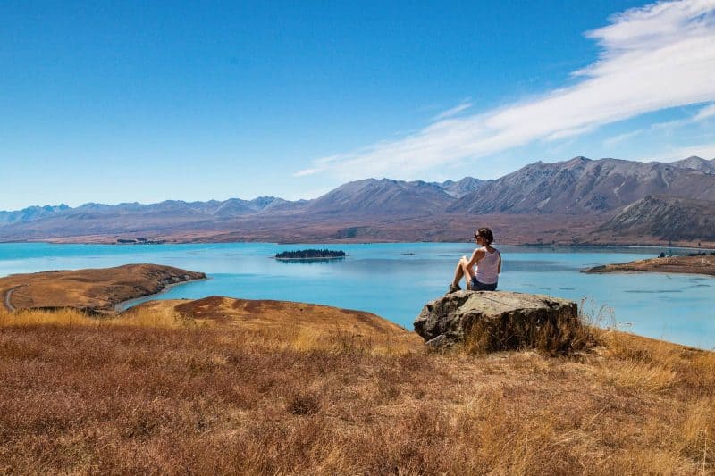
While the hike isn’t too hard, there is a lot of uphill and a good chunk of it is fully exposed. I recommend doing this hike over driving up to the Observatory nearby because it can get crowded up there plus where’s the adventure in that anyway? 🙂
25. Kea Point Hike
- Distance: 3.2km
- Difficulty: Easy
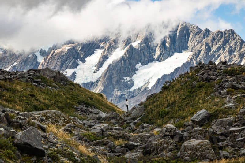
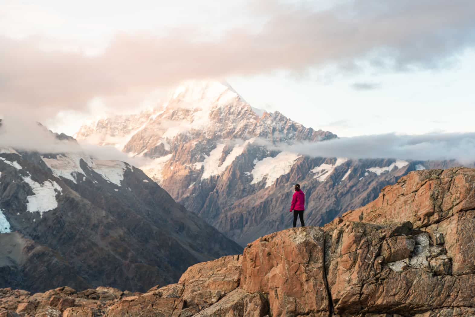
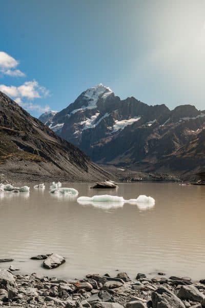
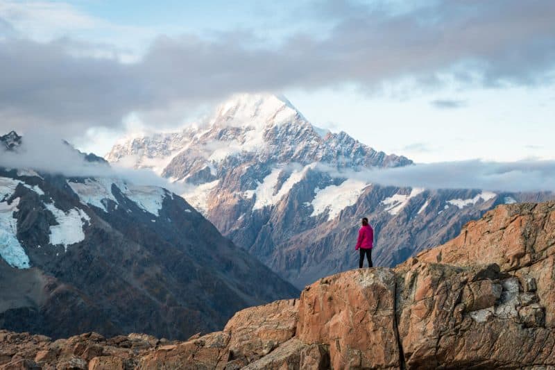
The Kea Point Hike is just over three kilometers long, and therefore is a great way to get a taster of the landscape that is at Mount Cook National Park. There are incredible views the whole way round, with waterfalls tumbling from glaciers in the distance, Mueller Lake below, and mighty Mount Cook in the distance.
26. Red Tarns Hike / Continue to Mount Sebastopol
- Distance: 2.4km*
- Difficulty: Easy*
Depending on how far you would like to go, this hike can be shorter or longer, easier or harder. After a series of steep steps, the red tarns will lie before you, sitting below the towering structure of Mount Cook.
You can turn around to loop back or clamber over some rocks and through bushes to continue to Mount Sebastopol to get additional views of Hooker Valley radiating before you and an even better vantage point of Mount Cook.
The Red Tarns Hike is pretty easy although you will be going up steps the whole way but, if you’re able to, continuing on will be well worth it, just turn left when the boardwalk at the top starts.
*The mileage on this one is only for the Red Tarns hike, I didn’t track how much extra the summit to Mount Sebastopol was and there’s not much info on it at all! I’d estimate it’s another 1.5 kilometers round trip and would make this hike more moderate than easy.
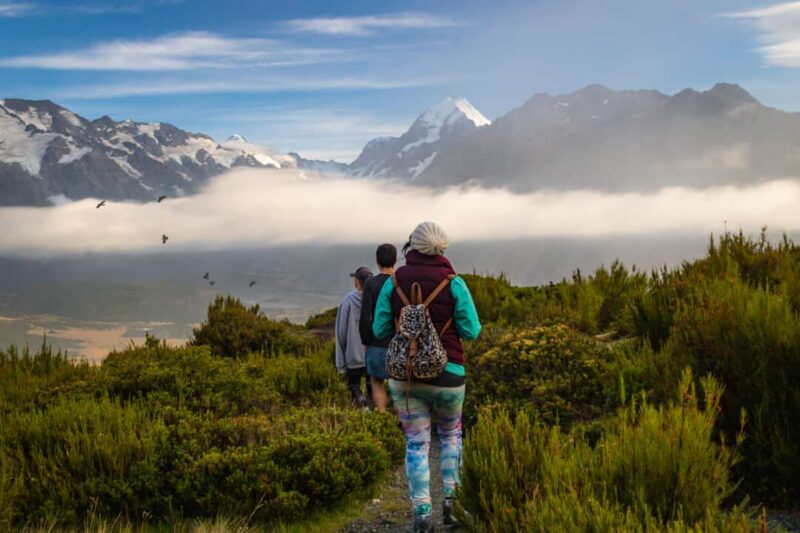
27. Hooker Valley Track
- Distance: 10.5km
- Difficulty: Moderate
The Hooker Valley Track is the most popular hike in the park and do I dare say possibly one of the most popular hikes in New Zealand.
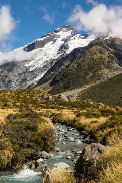
Every single step is worth it and will bring you to the glistening Hooker Lake which frames Mount Cook in the distance. The hike is actually quite easy but is perhaps rated as more of a moderate hike due to its length and the fact that it’s totally exposed.
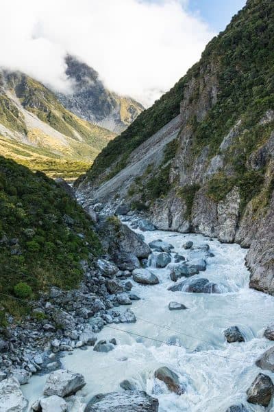
28. Tasman Lake & Blue Pools Hike
- Distance: 3.5km
- Difficulty: Easy
For views of glaciers and icebergs, take the easy Tasman Lake and Blue Pools hike.
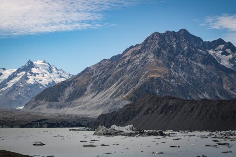
This is the best way to visit the lovely Tasman Lake and very nice Blue Pools which are easy to visit along a well-trodden loop, ideal for those that are looking for a quick and easy hike in New Zealand.
29. Sealy Tarns Hike / Continue to Mueller Hut
- Distance: 4.5km / 7.9km
- Difficulty: Moderate/Hard
The hike up to Sealy Tarns is really stunning, with views of the valley and Mount Cook along the way. There are a LOT of steps, but once you reach the summit you will know it has all been worth it.
For those up for a further challenge can continue to Mueller Hut. If you stay here, it gives you the incredible opportunity to watch the sunrise and sunset.
Related: 5 Epic Hikes in Mount Cook National Park That Are TOTALLY Worth It
30. Fox Glacier
Recommended by Louis from TheNorthernBoy
- Distance: 3.4km
- Difficulty: Moderate
Fox Glacier is one of the easiest and most accessible glaciers in the world, making it extremely popular amongst tourists and locals in New Zealand.
No New Zealand road trip is complete without making a visit to the amazing mountain range around the glacier. If you enjoy being outdoors and exploring breathtaking scenery, then you tackle this New Zealand hike.
To visit the Fox Glacier, you have a few different options:
Option 1 – You can do the Fox Glacier walk which is an easy flat hike that will take you between 1-2 hours return to complete. However, the hike does not take you onto the glacier, but it does take you to a barrier that gives epic views of Fox Glacier.
Option 2 – If you have the budget, then you should definitely consider doing the helicopter ride around the glacier. A helicopter ride will last between 20-40 minutes! Also, if you’re feeling extra adventurous you can pay extra for your helicopter to land on Fox Glacier.
Here are a couple of tips for your visit:
- Make sure to wear suitable footwear if you’re doing the hike. If it’s raining, the ground gets very sodden and muddy in areas.
- The barrier is there for a reason and you SHOULD NOT pass it! The glacier is unpredictable in which ice and rocks can fall at any time.
- You should stay in Weheka for the night, there are plenty of places to stay and there are some really cool lodges.
This is one of the memorable hikes in New Zealand you will do! Fox Glacier and the surrounding mountains are unbelievably stunning.
31. The Copland Track
Recommended by Danny from What’s Danny Doing?
- Distance: 36km
- Difficulty: Intermediate
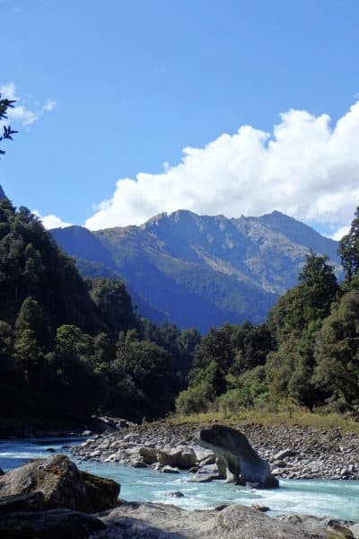
The Copland Track is one of the greatest hikes you’ll find on South Island.
Situated 26km south of Fox Glacier, it’s certainly one of the best multi-day walks on the wonderful West Coast.
Does a hike past glacial waters, across swing bridges, below mind-boggling mountains and through lush forested areas sound good? Well, it is! And the cherry on top? Your reward for making it to the end are the Welcome Flat hot pools.
You literally get to soak in hot pools located right next to the hut. At night, with the stars out in force, the mountainous amphitheater as your environment, and the hot pools to hang out in, the Copland Track hike in New Zealand provides an unforgettable experience.
Yet the track remains relatively unheard of compared to other hikes in the south but that’s not a bad thing!
Starting at the car park (well signposted off State Highway 6), the track starts with an instant river crossing. No bridges here. It’s a matter of hoisting your, hopefully, ultralight backpack, taking your shoes off and wading across.
In bad weather, you won’t be able to cross here at all. The waters rise and rush through at incredible speeds. Wait for good weather and check with DOC beforehand if the track’s even open.
This won’t be the first river crossing to get through. But with this initial foray into Copland sorted, it’s onto the main trail. The beauty of the Copland Track is like no other.
Rated intermediate, it’s a 2-day hike and a one way in, one way out kind of deal. You retrace your steps on day 2.
Most people will be able to hike the Copland with ease. It’s a steady ascent up to the hut (make a booking before going), but it’s nothing too trying. In fact, you follow the river valley for much of the walk. This makes it nice and flat for a large portion of it.
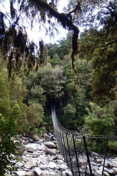
That said, there are a couple of steep ascents throughout and one significant climb at the end. These get the legs and lungs busting! Likewise, you need a head for heights. The aforementioned swing bridges are long, bouncing, and high.
32. Franz Josef Glacier Track
Recommended by Jon from See the South Island
- Distance: 5.6km round trip
- Difficulty: Easy
If you’re looking for an easy hike with lots of scenic variety, the Franz Josef Glacier Track shouldn’t be missed. This relatively flat track takes you through a glacier-carved valley to a viewpoint overlooking Franz Josef Glacier.
The glacier itself isn’t the most impressive part of the track though (it’s a bit grey and is quite a distance from the viewpoint) – the views along the way are the real highlights.
There are several spots where you can see right down the valley, which is flanked by rocky peaks and lots of trees. This track is also home to Trident Falls, one of the most spectacularly positioned waterfalls in New Zealand. From there you can see all the way down the valley to the glacier.
The track should take around 90 minutes (add a little extra if you’re walking from town) and is suitable for most levels of fitness. As with most places on the West Coast (one of New Zealand’s wettest regions), the weather can play a huge part. The first time I did this hike it started raining heavily around halfway through, which was a bit miserable. For the best chance of good weather, you should do it early in the day.
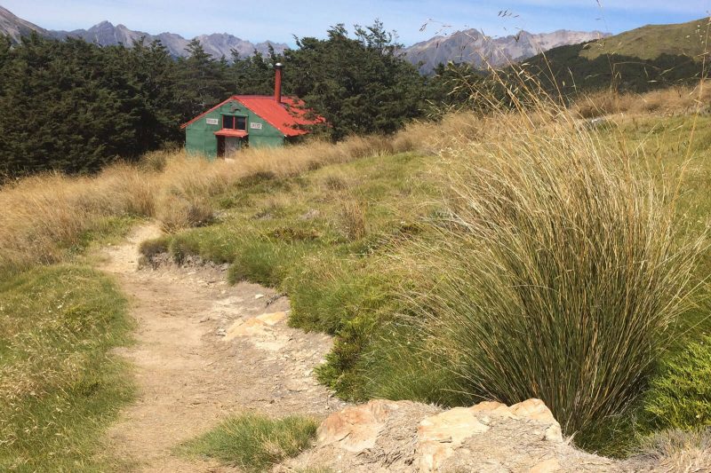
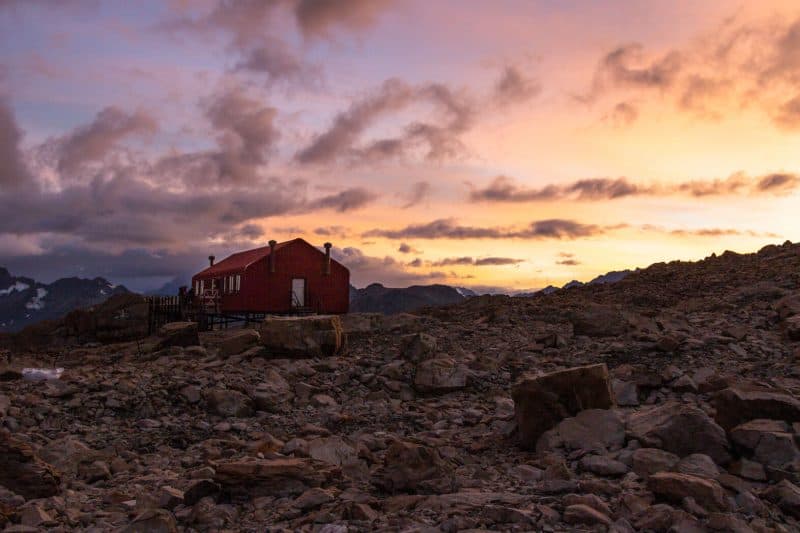
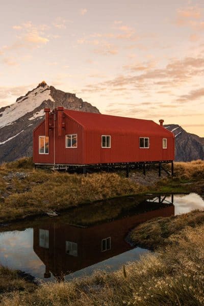
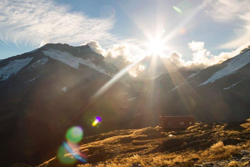
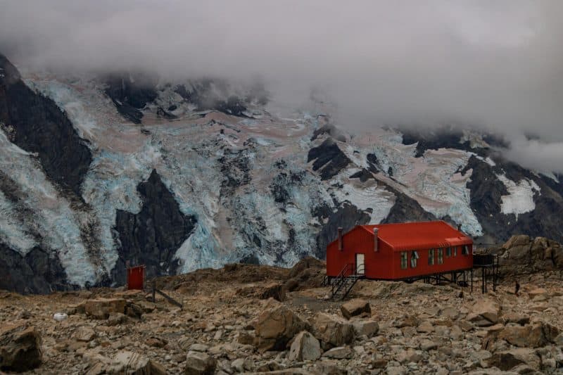
33. Brewster Hut
Recommended by Katie from Two Wandering Soles
- Distance: 10.6km
- Difficulty: Hard
Spending the night in a mountain hut is definitely worthy of a spot on an adventurous New Zealand bucket list. And with nearly 1,000 huts scattered throughout the country, there are plenty to choose from.
If you’re looking to spend the night in a hut that isn’t too crowded, yet is accessible in just a few hours of hiking, Brewster Hut fits the bill perfectly.
This hike is not for the fainthearted – it’s a difficult climb with an elevation gain of nearly 1,000 meters. You’ll make your way through a beechwood forest where the moss-covered trees block any views you might have of the landscape that surrounds you.
Eventually, the forest ends as you climb past the tree line. All your efforts are rewarded with 360-degree views of Mount Aspiring National Park. Snowcapped peaks surround you, making this one of the most incredible views in all of New Zealand. From the end of the tree line, it’s roughly another 30-minutes on a narrow ridgeline, so watch each step carefully.
Brewster Hut, with is cardinal red exterior is a welcomed sight and offers an escape from the strong and sometimes unrelenting winds. Inside you’ll find a kitchen and common space as well as a sleeping area that can accommodate 12 people. Note that you must reserve your spot during high season.
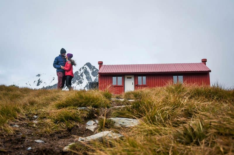
Now that you’ve made it to the hut, it’s time to relax with a game of cards, mingle with other hikers, cook some backcountry food, and explore the area with your camera. And be sure you don’t miss the sunset!
Before making this hike, look up the current weather conditions, as this region can sometimes be snowy even during the summer months. Make sure you’re prepared with the proper equipment. Also, it’s important to pack in enough water. There are giant rainwater collection tanks at the hut, but they can run out, and you don’t want to be stuck for the night without water for drinking or cooking.
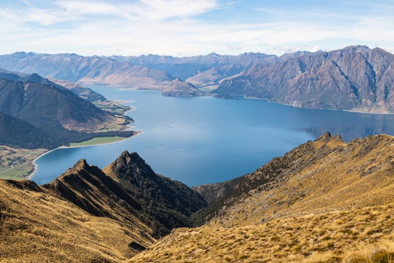
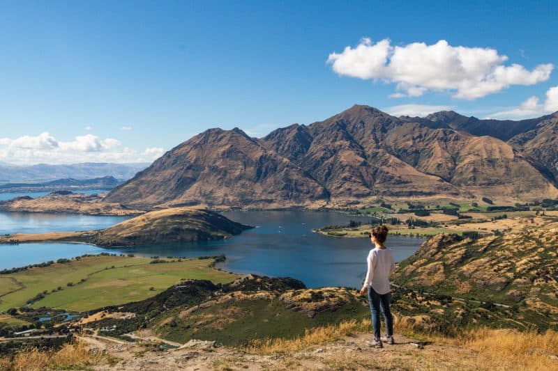
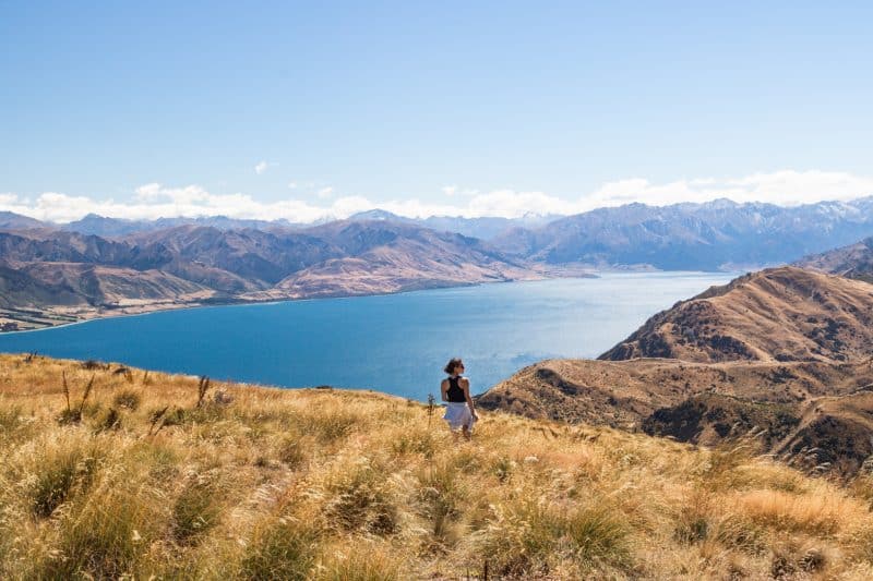
34. Roy’s Peak
- Distance: 15.6km
- Difficulty: Hard
The Roy’s Peak hike is a 15.6km round trip up a mountain, so it’s not the easiest of hikes, yet it is extremely popular. The wide gravel track takes you up the side of the mountain through a series of switchbacks. You don’t need to be a pro hiker to do it, but the length and the steepness makes it pretty hard. If you don’t mind the crowds, the view is pretty spectacular from the top.
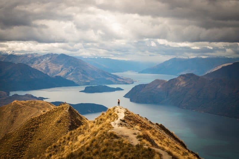
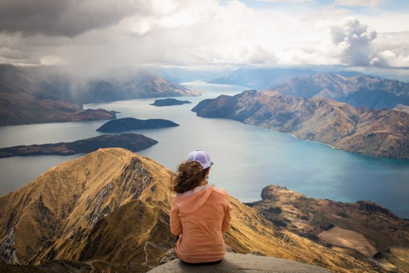
You’ll get a 360 view of the dramatic surrounding landscape including views of Lake Wanaka, glinting glaciers and a ridgeline of towering mountains in the distance. You are so high up you may even get snow flurries in the hight of summer, which can be a pretty cool experience.
It is not surprising that many people think it is one of the best hikes in New Zealand, just look at those views!
35. Isthumus Peak
- Distance: 15.9km
- Difficulty: Hard
This hike is pretty similar to the Roy’s Peak hike, just much less crowded.
It is the same difficulty and distance and offers a fair few of the same views, which means it is a great option if the Roy’s Peak hike is too busy or if you are just looking for another alternative hike in New Zealand.
Having done both though, I can say, yes, Roy’s Peak has slightly better views!
36. French Ridge
- Distance: 38.6km
- Difficulty: Hard
If you fancy using a toilet with one of the best views in the world, then take the hike to the French Ridge Hut. The hike is nearly 20km one way but is deceptively difficult, with the most difficult parts coming at the very end. To start with, the trail is pretty flat, however, there is not much shade which it rough particularly if you are hiking New Zealand in the summer months.
Before you begin the ascent to French Ridge Hut, you’ll need to cross an icy river. After this, you are greeted by a vast mountain, and for the next few hours, you will literally be climbing, using the trees and rocks to help you up.
You then have the ridgeline of a mountain to tackle for around another hour, so you will be very happy when you see the red roof of the hut! No one said hiking in New Zealand would be easy! This hike really makes you work for it and was the most challenging hike I did during my time here.
You’ll definitely want to stay in the hut for the night after this hike, coming back down in the same day would be quite difficult in my opinion. Read everything you need to know before hiking up to French Ridge Hut.
37. Rob Roy Glacier Track
Recommended by Josh from The Lost Passport
- Distance: 10.3km round trip
- Difficulty: Hard
Though not many people talk about it, Rob Roy’s Glacier Track is one of the most stunning walks around the Wanaka region. It is located approximately 50 kilometers northwest from Wanaka in the Mount Aspiring National Park.
The first half of the road to Rob Roy’s Glacier Track is sealed and in good condition, an easy drive. The second half of the road, however, is more questionable. A gravel track with large potholes and washed out sections of road can make it quite slow and difficult to traverse for those in a campervan. You should allow about 1.5 hours to drive this route one way in the daytime.
Reaching the track, you will leave your vehicle at the Raspberry Carpark and take a brief walk through private farmland until crossing a swing bridge into the forest. Here you will find there are two separate lookout points that you can hike to; the lower an upper lookout.
The lower lookout is located at about half distance and offers a view of the glacier through an opening in the forest. It’s a nice view, but not something overly impressive.
The upper lookout is located at an opening at the end of the trail. Up here you will be surrounded by an epic view of mountains, glaciers, and waterfalls all around.
38. Diamond Lake Track
- Distance: 6.8km
- Difficulty: Moderate
DON’T do this hike if you only have intentions of doing the Diamond Lake Loop.
The lake is nothing special, however, if you go to the top of Rocky Mountain you get awesome views of Wanaka from above and from a few different angles. It’s a great little workout and the summit is perfect for sitting down and having a quick snack.
39. Grandview Creek Trail
- Distance: 13km
- Difficulty: Moderate
This is a relatively easy hike but it’s long with a gradual incline almost the entire way. While the views from the top are beautiful, the trail is very long and kind of uneventful the majority of the way.
What I did love was the cows and horses along the way, the fact that NOBODY was on the hike with me and the great work out it gave my glutes. You can also walk a few extra kilometers up to the top of the hill.
The one thing I didn’t love was the copious amount of poop along the trail… Wear good shoes and watch your step. Also, this hike is entirely exposed so bring tons of water and sunscreen.
40. Routeburn
- Distance: 33km*
- Difficulty: Hard*
The Routeburn Track is one of New Zealand’s Great Walks, it is 33km long and very, very popular, with some of the huts on the trail booked up a year in advance!
However, you shouldn’t let this put you off, they are popular for a reason. For a start, you’ll pass stunning waterfalls, glaciers and mountain lakes, plus a number of breathtaking views along the way.
A great way to tackle the hike is to do one side one day, and then save the other half for another day (saving you hundreds of dollars by the way!). You’ll pass a deep, golden valley surrounded by towering cliffs, with the highlight being Harris Saddle which sits almost in the middle of the route.
*Make sure to read my Routeburn Track post to see if doing part of it as a day hike only is best for you! You may agree with me and my assessment of the hike and doing it the way I explained can save you tons of money and a whole extra day!
41. Jack’s Point
- Distance: 14km
- Difficulty: Moderate
I have no idea how this hike isn’t more popular. With it’s proximity to Queenstown, you’d think people would be flocking here but for some reason, we had this hike, during high season, all to ourselves, and we were not mad about it!
The parking lot is even great because you get a prime viewing point of all the skydivers jumping over The Remarkables. The hike takes you through some farmland and along the coast with views of Queenstown in the distance.
42. Kepler Track
- Distance: 60.7
- Difficulty: Hard
The 1 to 4 day Kepler Track hike is one of the best hikes in New Zealand, taking you through the incredible landscapes of Fiordland National Park on South Island. You’ll weave through lush bushland, traverse the ridgeline of the Luxmore Mountain and walk along the shores of the tranquil Lake Te Anau.
You can either go clockwise or anti-clockwise, starting and finishing in the same location. This awe-inspiring track was created to show visitors the very best features of Fiordlands, including glacier-carved valleys, mountains, native forests and plenty of waterfalls.
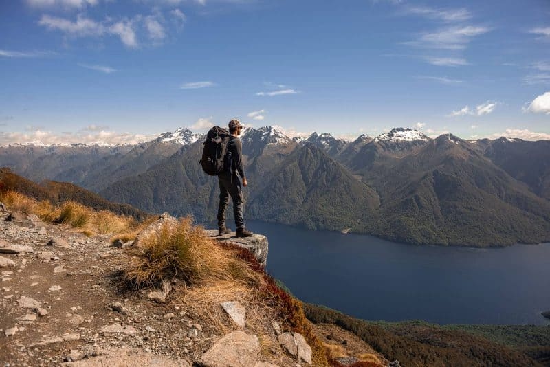
The custom-made pathway was built for pleasure, therefore makes for easy walking, with most streams bridged, boardwalks covering boggy areas and the steep sections have steps.
43. Tunnel Beach Track
- Distance: 1.6km
- Difficulty: Easy
There are some beautiful walks in Dunedin, all of which are relatively easy to navigate. The most popular is the Tunnel Beach Track, and although it’s only around a mile round trip, there is a steep climb back to the starting point.
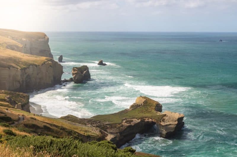
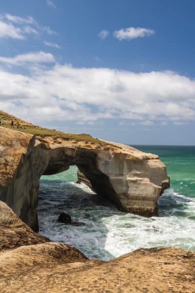
The views along the way are incredible, finishing with a gorgeous natural rock archway, reached only by entering a narrow tunnel down to the beach.
44. The Sandymount Track
- Distance: 3.1km
- Difficulty: Moderate
The Sandymount Track can be found in the Otago Peninsula and is a 3km loop along a sandy track.
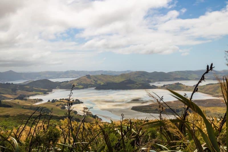
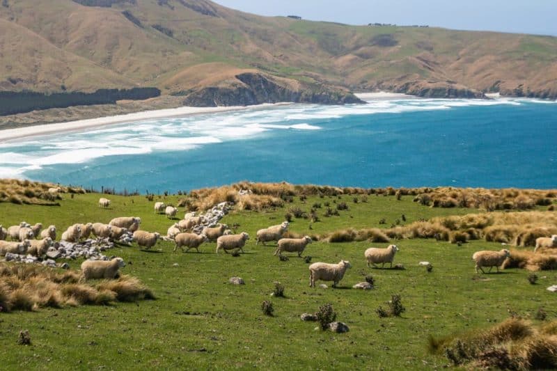
The trail gives way to some lovely views of Sandfly Bay, Lover Leap and the Otago Peninsula plus tons of sheep.
45. Harbour Cone Track
- Distance: 4.2km
- Difficulty: Moderate
For lovers of reaching high places, take the Harbour Cone Track up a steep hill to one of the best views of the Otago Peninsula in the area from Taiaroa Head to Hoopers Inlet and beyond.

46. Nichols Falls
- Distance: 1.4km
- Difficulty: Moderate
Although it is slightly difficult to find, Nichols Falls is gorgeous, surrounded by lush ferns and a towering cliff.
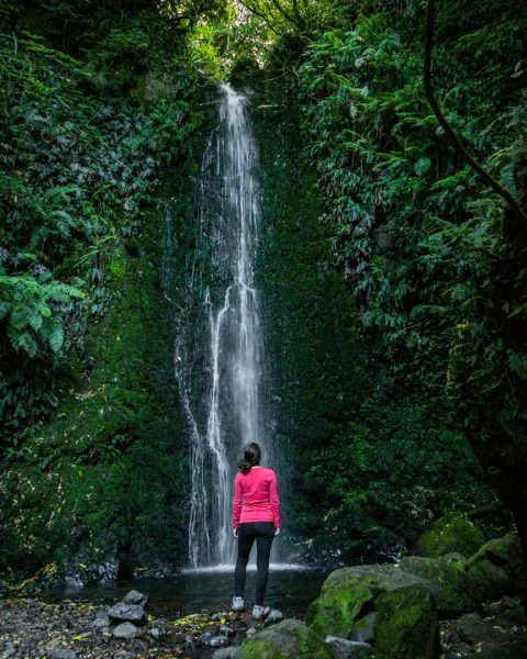
It is also where you’ll be able to find a short walk to a fern ravine where you may be able to spot some glow worms but you’ll have to come back when it’s dark.
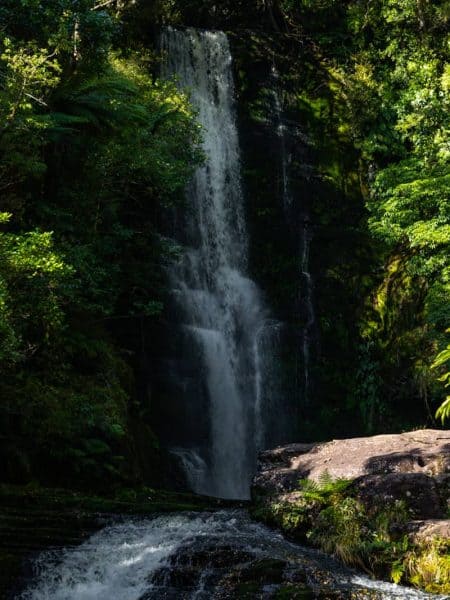
47. Waipohatu Trail
- Distance: 6km
- Difficulty: Moderate
Sitting at the southern tip of South Island, the incredible area of The Catlins should not be overlooked when hiking New Zealand, mostly due to the towering waterfalls.
The first of which can be found by following the Waipohatu Trail. The hour-long hike will lead you to not one but two huge waterfalls, plus you’ll likely have the view mostly to yourself.
48. Koropuku Falls
- Distance: Not sure! There’s no info on this one! About a 30 minute round trip walk.
- Difficulty: Easy
Hunt out the trailhead to Koropuku Falls for a short and easy hike to another picturesque waterfall.
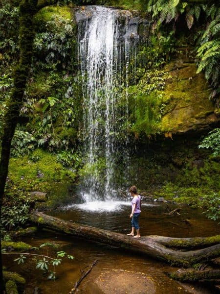
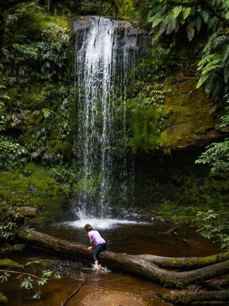
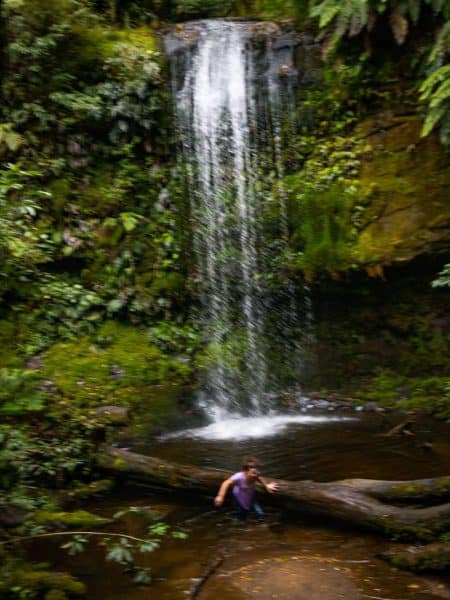
For some reason, most don’t stop at this lonely little side of the road hike. But a quick jaunt through some forest and you’ll be at the base of the falls. The hike is quite easy although it can get a bit muddy.
PRO TIP: The tree trunk at the base is slippery (*shocking news*) as outlined in my epic gallery of photos of me falling in… Enjoy the laugh.
49. Mclean Falls
- Distance: 1.8km
- Difficulty: Easy
Be sure to save some energy for the walk to Mclean Falls. This is one of the most popular of the Catlin waterfalls, and as soon as you see it, you’ll see why.
It’s beautiful and pretty easy to reach, plus you’ll pass smaller falls on your way there.
50. Cathedral Caves
- Distance: 1.8km
- Difficulty: Easy
For a little bit of something different, the Cathedral Caves is open for exploring, but only when the tide is low!
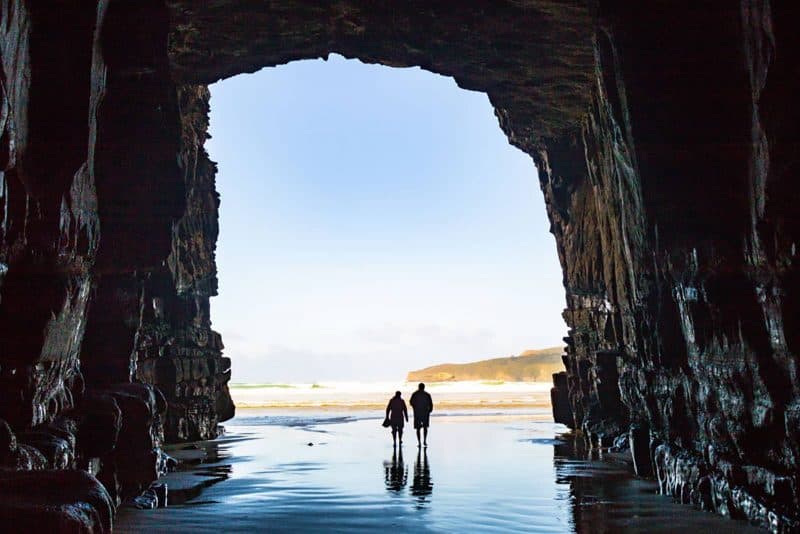
The huge cathedral-like cave can be reached in around 20 minutes, and it is quite spectacular to see something so huge created by the power of the waves.
51. Rakiura Track, Stewart Island
Recommended by Rohan from Travels of a Bookpacker
- Distance: 37km
- Difficulty: Moderate
The Rakiura Track is the least visited of New Zealand’s Great Walks but don’t let this fool you into thinking it’s not worth it. The isolation is part of the insane beauty of this hike and even in the peak of summer, you won’t have to share the track with hoards of other people.
Located on New Zealand’s third-largest island, Stewart Island, this hike is off the beaten path but offers some of the best chances to see New Zealand wildlife including the elusive kiwi. The hike is easy going and for keen hikers can be done in just two days but is most commonly completed in three days two nights. There are both huts and campgrounds along the way which need to be booked in advance.
Weather on Stewart Island is known for being unpredictable and can be very wet so make sure you pack waterproof gear. You’ll also need to carry all your own cooking and camping equipment.
The track starts with an easy walk through native bush along a coastal path to a choice of two campgrounds or a hut all located on stunning secluded beaches. Day two is the longest with a few uphill climbs through dense bush and an overnight stay prime kiwi spotting territory before the final short day back to the picturesque little town of Oban and ferries back to the mainland.
Tips for Hiking in New Zealand
The Sun
Sunscreen is not an option, there’s a hole in the ozone layer here and take it from me, you can feel the sun here. I’m from Florida and I could literally feel the sun burning my skin. It’s a real thing, bring some, use it often, put lotion on after showers and take care of that skin!
On that same note, you’ll need tons of water on the hikes. Luckily, some trails will have water fill up, like when you’re passing a hut but usually, you’ll need to bring your own to last you the entire hike.
Weather and Clothing
Weather is psycho in New Zealand. You can be drench in sweat one second, freezing the next, and in a rain jacket shortly after… You must pack for all type of conditions if you tackle any of the harder hikes and huts. I always carried my shell from my favorite jacket just in case it rained or it got cold or windy.
I only wore Merino Wool socks as they are quick-drying and warm. My shoes were proper hiking shoes (if I was here in colder months I would have worn these) for extra traction on slippery rocks if it rained… All of these things are like, “OK, yeah, yeah whatever, I get it!” In your mind, but they really need to be taken seriously when hiking in New Zealand.
There are people who get rescued every year because they underestimate New Zealand’s weather and are not properly equipt to survive when things go haywire.
Use DOC
DOC is the Department of Conservation in New Zealand and they are pure GOLD! I’ve never traveled to a country who took such good care of their hikers.
Every region of New Zealand has an office and you can call them and speak to a ranger about any of the trails in their area. This service is invaluable because as you’ve gathered by now I hope, the weather is crazy and the rangers are there to access and tell you if the hike is still safe.
If you’re taking on any of the easier hikes, you’re good to just go, but any of the moderate and difficult hikes, and definitely if you’re staying in any of the huts, it takes two seconds to ring them up and ask them if the conditions are safe.
Hemispheres
Just a quick reminder if you’re in the northern hemisphere, don’t show up to hike in New Zealand in June with shorts and a tank top, that’s their winter.
Keep in mind they have opposite seasons of my European and American friends… and also, as discussed above, they have some serious hikes and crazy weather, so pack accordingly. Some of the easier hikes in New Zealand will go from easy peasy to needing an ice ax and crampons very quickly.
The difficulty stated above for all the hikes are during normal conditions. With adverse weather, the trails could close or only be open for true mountaineers.
Book Your Hut
Depending on which huts you want to hike to, it’s best to book them in advance. I know it’s not always fun to plan so far in advance but sometimes it’s necessary here. If you’re doing one of the Great Walks, the huts can book out a year in advance!
When I went hiking to Mueller Hut, the next available was two weeks out. When I hiked French Ridge, we just showed up as it’s first come first serve and we only had eight others with us. It all depends but the more popular the hut, the more likely you’ll need to reserve.
TIP: If the hut you want is fully booked, double-check if the tent sites are available. Those usually don’t book out or are on a first come first serve basis. You will need to provide all your own tent gear and sometimes you are not allowed to use the facilities in the hut.
You can also stalk the website for cancelation and nab your hut booking that way too.
The Best Time to Hike in New Zealand
December and January are great times to hike as the weather is perfect but this means everyone else and their mom is also there to hike during the great weather.
February to April are equally as great and the crowds have thinned out. May starts to get tricky particularly with any of the hikes that are in alpine climates. Most hikes in winter require you to be an alpinist or mountaineer.
At the end of the day this isn’t a written in stone rule of when to hike in New Zealand but a rough guideline, it all depends on the hike and the area at the end of the day!
Food Tips
For any of the regular hikes, a simple apple and trail mix or something will do. If you’re doing the multiday trips and huts, you’ll need something more.
To keep things light and easy, we made the choice to NOT cook any meals on the trail. Yes, it was a bit hard to not have a hot meal but we got over it and were thankful for not having to lug around the extra weight.
If you’re just doing a one night, this is super easy and the best choice. We made PB&J’s, packed nuts, apples, dried fruit, and granola bars to sustain us.
Nothing is Provided at The Huts
The huts are extremely basic. You’ll need to bring your own everything here.
The only thing that’s provided are mats to sleep on. You’ll need a sleeping bag (and a really good and warm one at that), your own food, pots, and pans, sometimes you’ll need to bring your own fire too as many huts have kitchens but no equipment.
Don’t book a hut and come with nothing but your hiking boots and your camera. You actually need to pack everything with you and back out as well. There are no trash cans at the huts.
Having Your Own Vehicle is a Must
OK, fine, yes, you can do some hikes without your own car but wow… will it be a ballache! Most of the hikes and trailheads are not easily accessible via a mode of public transportation and having your own car will be invaluable.
Plus after a rough hike, I got back to my van, baby wiped myself down, changed, ate… If I had to figure out the bus system after a big hike I would have *cue exaggeration* died. Seriously, at the end of the day, driving is the best way to see New Zealand and the majority of the hikes here would be impossible without driving yourself.
More New Zealand Hikes
>>> EVEN MORE ABOUT TRAVELING NEW ZEALAND <<<
Work & Travel New Zealand: Get a Working Holiday Visa for New Zealand
Your Guide To the Tongariro Alpine Crossing in New Zealand
A 5-Day Queenstown Itinerary For the Intrepid (New Zealand)
2-Week North Island, New Zealand Road Trip Itinerary
New Zealand Road Trip Itinerary—2 Weeks to 2 Months + Costs and Tips
20+ Day New Zealand South Island Road Trip Itinerary
Campervan Sites in New Zealand + Camping and Food Tips
New Zealand Travel Tips + A Budget Breakdown
Campervanning New Zealand: Buying, Selling, Renovating, and Tips
Piha & Waitakere Ranges Walks, Waterfalls, and Beaches—New Zealand
A Guide to The Pouakai Circuit & Hut at Mount Taranaki (New Zealand)
11 Fab Things to Do in The Coromandel, New Zealand
Epic Things to Do in Rotorua—Hot Pools & Adventures
7 Tips For The Cathedral Cove Walk in The Coromandel, New Zealand
A Guide to Hiking French Ridge Hut in Aspiring National Park (New Zealand)
Hooker Valley Track: The Easiest & Most Beautiful Hike in Mount Cook NP (New Zealand)
5 Things to Know about Milford Sound, How to See It and Is It Worth It? (New Zealand)
An Adventurer’s Guide to Exploring Lake Tekapo, New Zealand
4 Easy But Beautiful Walks Around Dunedin, New Zealand
11 Things to Do in The Catlins in 2 Days (New Zealand)
A Guide to Exploring The Cave Stream Scenic Reserve (New Zealand)
Save this pin to your New Zealand board NOW!
TAKE THE SHORTCUT
Want to know how to live abroad without being rich?!
Get my shortcut! It's THE ONLY guide you'll need on how to sustain a life abroad—NO BS!
GIVE IT TO ME 😍
This is the best hiking resource for New Zealand ever written! Great job 🙂
Thank you!
New Zealand is really an amazing place! We had a great time as a family a few years back. Your hiking guide is very comprehensive and definitely helpful to anyone going in the future! Well done!
So glad you found it helpful! 🙂