5 landscapes on Earth that look completely fake (they’re not)
Some places don’t look like they belong on this planet, and that’s not a figure of speech. These five actually look manipulated in photos until you realize nobody touched a thing — it’s just what the ground does there.
No filters, no drone tricks, no AI slop. Just rock, salt, sand, and one very strange bug doing exactly what geology and biology have been doing for millions of years. Here are five landscapes so strange you’ll want to double-check they’re real before you book the flight.
1. Zhangye Danxia, China
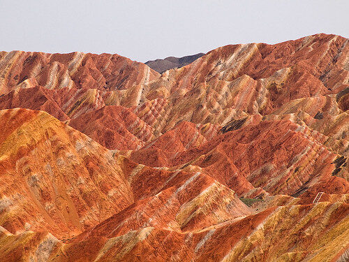
Picture a mountain range striped in red, orange, yellow, green, and blue like someone dragged a paintbrush across it. That’s Zhangye Danxia National Geological Park in China’s Gansu province, and no, it’s not touched up for postcards.
The color comes from more than 24 million years of sandstone and mineral layers getting pressed together, then buckled upward by shifting tectonic plates. Iron and other trace minerals oxidized differently in each layer, which is why the ridges look striped instead of just… brown, like most mountains have the decency to be.
It only became an official national geopark in 2011, which is wild considering National Geographic put it on a list of the world’s top geographical wonders. The park covers about 510 square kilometers, so budget more than a quick photo stop if you actually want to see the range of colors.
2. Waitomo Glowworm Caves, New Zealand
The “glowworms” lighting up the ceiling of this cave system aren’t worms at all. They’re the larvae of a carnivorous fungus gnat called Arachnocampa luminosa, and yes, that’s a real species name and not something out of a fantasy novel.

Each larva glows blue-green by combining a chemical called luciferin with oxygen and an enzyme in its own body, then dangles sticky silk threads to snag insects drawn in by the light. The hungrier it is, the brighter it glows — which, honestly, is a more honest hunting strategy than most predators bother with.
A Māori chief named Tane Tinorau first fully explored the caves by candlelit raft in 1887, alongside a British surveyor. You’ll do it a little more comfortably now, gliding through on a quiet boat tour with the ceiling lit up like a planetarium above you.
3. Deadvlei, Namibia
Deadvlei is a bone-white clay pan in Namibia’s Namib-Naukluft Park, ringed by some of the tallest sand dunes on Earth — the biggest, nicknamed “Big Daddy,” tops out around 380 meters. Scattered across the white clay are blackened camel thorn trees that have been dead for roughly 900 years.
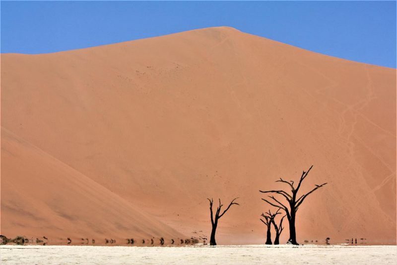
They haven’t decomposed, because the Namib is too dry for rot to do its job. The trees died once shifting dunes cut off the river that used to feed the pan, and instead of rotting away, they just… stayed, scorched black by centuries of sun against a floor so white it looks bleached on purpose.
You can walk right up to the trees, which somehow makes the whole scene stranger, not less. If you’re already planning the drive out there, I’ve mapped out a full self-drive Namibia itinerary that covers Sossusvlei and the rest of the route.
4. Cappadocia, Turkey
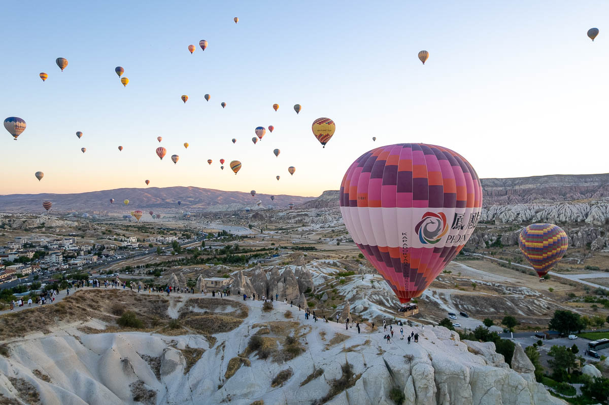
Cappadocia’s famous “fairy chimneys” started forming about 14 million years ago, when volcanic eruptions buried the region in ash that hardened into a soft rock called tuff, later capped by tougher basalt from later lava flows. Wind and water spent millions of years wearing down the soft tuff underneath, leaving tall pillars with harder basalt caps balanced on top like stone mushrooms.
Some of these spires reach 130 feet tall, and people have been carving homes, churches, and entire underground cities into them for close to 4,000 years. I’ll die on this hill: the sunrise balloon ride over them is worth the early alarm, and I wrote up exactly what to expect in my 3 days in Cappadocia guide if you want the full rundown.
5. Salar de Uyuni, Bolivia
At roughly 10,000 square kilometers, Salar de Uyuni is the largest salt flat on Earth, sitting at nearly 3,650 meters above sea level in the Bolivian Andes. It formed when an ancient saltwater lake dried up 30,000 to 40,000 years ago, leaving behind a crust of salt up to 10 meters thick in places and an estimated 10 billion tons of salt overall.
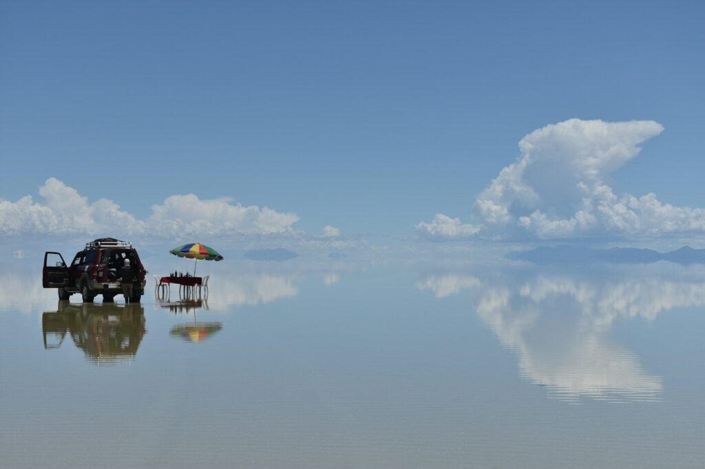
During the wet season, from November through March, a thin layer of water spreads across the surface and turns the entire flat into the world’s largest mirror, reflecting the sky so perfectly you’ll lose track of where the ground ends. NASA actually uses it to calibrate satellites because the surface is that flat and that reflective — which is either extremely cool or extremely funny, depending on your mood that day.
Would you rather see it dry and cracked into those famous hexagon patterns, or flooded into a giant sky mirror? Either way, it’s proof the most alien-looking place on the planet doesn’t require a passport to another world, just a long flight to Bolivia.
