13 Best Hikes in Death Valley National Park
This guide to hiking in Death Valley National Park is authored by Rasika.
Located in California’s Mojave Desert, Death Valley National Park is known for being the hottest, lowest, and driest place in North America. So why would anyone want to hike there?
Because Death Valley National Park offers over 100 miles of hiking trails that provide scenic views of the park’s varied and bizarre landscape! Here, we are sharing the highlights of the best hikes in Death Valley National Park so you can plan this part of your California road trip to a T!
Table of Contents
- Best Hikes in Death Valley National Park
- Easy Hikes in Death Valley National Park
- 1. Artist’s Palette Trail
- 2. Badwater Basin Salt Flats Trail
- 3. Father Crowley Vista Trail
- 4. Harmony Borax Works Trail
- 5. Salt Creek Interpretive Trail
- 6. Twenty Mule Team Canyon Trail
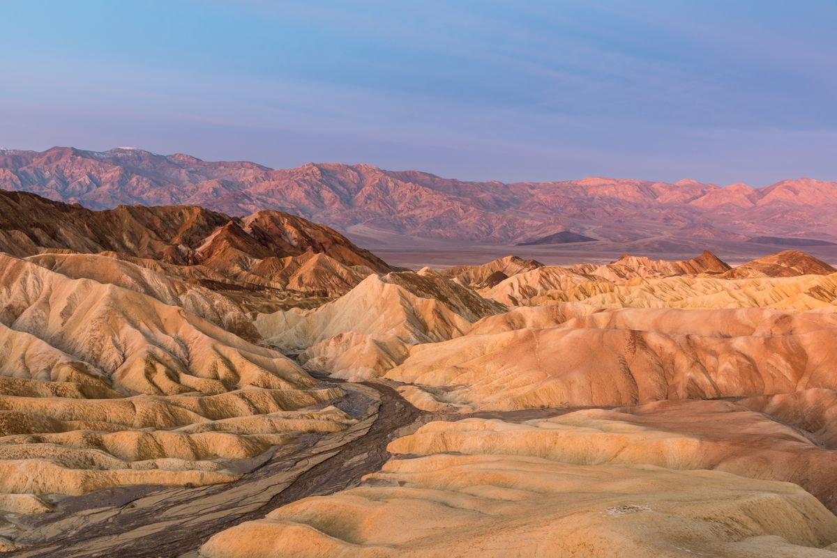
- 7. Zabriskie Point Trail
- Moderate Hikes in Death Valley National Park
- 8. Dante’s View Trail
- 9. Darwin Falls Trail
- 10. Natural Bridge Trail
- 11. Mesquite Flat Sand Dunes Trail
- Challenging Hikes in Death Valley National Park
- 12. Complete Circuit Trail
- 13. Telescope Peak Trail
- Things To Know Before Hiking in Death Valley National Park
- More USA National Parks
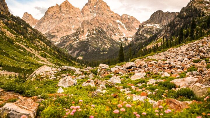
- 14 Best Things To Do in Grand Teton National Park
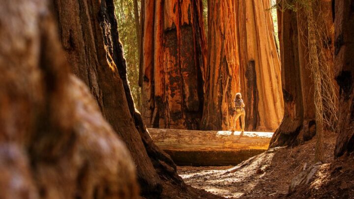
- 15 of The BEST Things To Do in Sequoia National Park
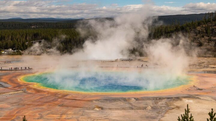
- Yellowstone National Park Itinerary + Yellowstone Country & Grand Tetons
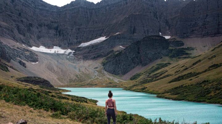
- Things to Do in Glacier National Park—Hikes, Camping, Tips & Itinerary (Montana)
- Where to Stay in Glacier National Park—Camping and Lodges (Montana)
- How to Get Seasonal National Park Jobs in The USA
Best Hikes in Death Valley National Park
Hiking is an enjoyable way to explore Death Valley National Park, with trails leading over rocky terrain through desert plant life. Hiking trails in the park vary in difficulty and distance but are fun for hikers of all ages, experience levels, and abilities. Here are the 13 best hikes in Death Valley National Park.
Easy Hikes in Death Valley National Park
1. Artist’s Palette Trail
Distance: 0.3 miles
Type of Trail: Out & Back
Elevation Gain: 108 ft
Time Spent: 15 minutes
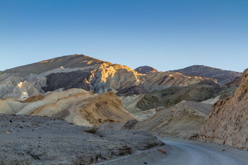
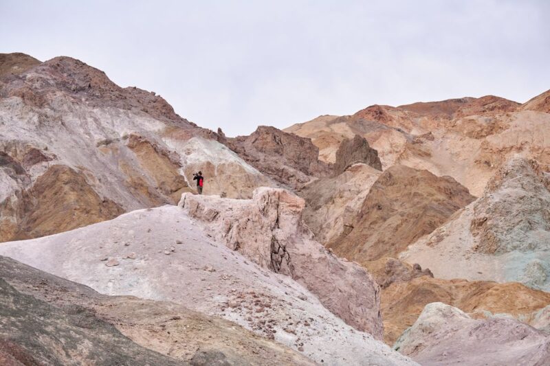
The Artist’s Palette is a collection of hills with pastel shades of blue, green, and pink. Located on Artist Drive, this palette was created over time due to weather and oxidation. It takes 4.5 miles (and 10 minutes) to get to the Artist’s Palette once you enter Artists Drive.
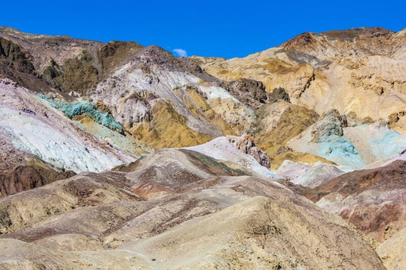
Insider Tip: Stay past sunset to see the color change on the Artist’s Palette.
2. Badwater Basin Salt Flats Trail
Distance: 1.9 miles
Type of Trail: Out & Back
Elevation Gain: 6 ft
Time Spent: 45 minutes
The most popular hike in Death Valley National Park, the Badwater Basin Salt Flats Trail, takes you through white polygon-like salt flats. It’s a vast landscape of salt flats that spans more than 200 miles.

This is also the lowest point in North America. These salt flats are rugged and spike up, so make sure you wear hiking shoes and pack proper hiking accessories.
Insider Tip: Does it feel like you’re 282 feet under sea level? Turn around at the parking lot (adjacent to Badwater Basin), and you’ll see a sign on the Black Mountains that says “Sea Level.” That’s where the sea level is, and you’re 282 feet below that.
RELATED: Your Southwest Road Trip Itinerary (1 Week – 2 Months)
3. Father Crowley Vista Trail
Distance: 1.2 miles
Type of Trail: Out & Back
Elevation Gain: 72 ft
Time Spent: 30 minutes

Located on the western end of the park, Father Crowley Vista shows you a beautiful view of the Rainbow Canyon. This canyon’s name comes from the colors created due to volcanic erosions over time. You might also see military test flights flying over this canyon.
Insider Tip: The Father Crowley Vista is near the Darwin Falls trail (more on this in a minute), so plan to do them both together since these are located farther from the other hikes.
4. Harmony Borax Works Trail
Distance: 0.4 miles
Type of Trail: Loop
Elevation Gain: 29 ft
Time Spent: 15 minutes
Go back in time to the 1880s in this trail. The Harmony Borax Works Trail shows you a historic mining site that includes wagons pulled by 20 mules. These wagons were used to carry borax for 165 miles from Death Valley to Mojave.
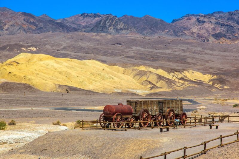
You can also learn more about borax production at its interpretive signs along the trail.
Insider Tip: Head back here again at night for stargazing. Watch the stars above a historic site.
5. Salt Creek Interpretive Trail
Distance: 0.8 miles
Type of Trail: Loop
Elevation Gain: 29 ft
Time Spent: 30 minutes
It’s scarce to see a body of water amid a desert, but when you do, you’ve got to add it to your itinerary! At Salt Creek, watch pupfish swimming around and pickleweed plants growing near the creek.
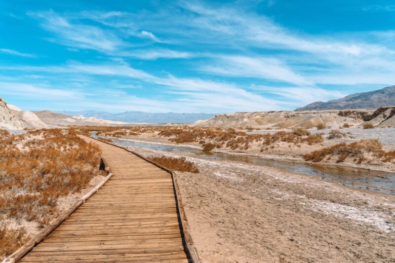
Insider Tip: Embrace the explorer in you and hike past the boardwalk. You’ll see steps to another trail. This trail leads you to McLean Spring, but you will start seeing water bodies before that.
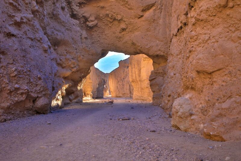
6. Twenty Mule Team Canyon Trail
Distance: 0.3 miles
Type of Trail: Out & Back
Elevation Gain: 65 ft
Time Spent: 15 minutes
The Twenty Mule Team Canyon Trail is a hidden gem, a lesser-known hike. Drive through the orangish-yellow badlands to get to the trail. Since Zabriskie Point can get too crowded during sunrise and sunset, come here instead!
Insider Tip: Hike further into the Twenty Mule Team Canyon to find mine tunnels and slot canyons.
7. Zabriskie Point Trail
Distance: 0.4 miles
Type of Trail: Out & Back
Elevation Gain: 49 ft
Time Spent: 30 minutes
Another popular hike in Death Valley National Park, the trail to Zabriskie Point, is steep and short but well worth the trek. Photograph the colorful wavy badlands and look for Manly Beacon, a peak that’s 823 feet high. You can see the salt flats and the Panamint mountains past Zabriskie Point.
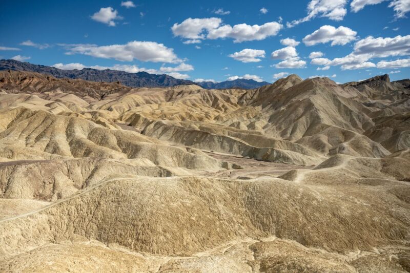
Insider Tip: Most hikers stop at the overlook spot but hike down further into the badlands – be one among them!
RELATED: California Road Trip Itinerary: 19 Must-Visit Stops!
Moderate Hikes in Death Valley National Park
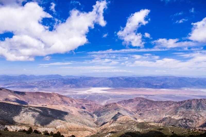
8. Dante’s View Trail
Distance: 1.0 miles
Type of Trail: Out & Back
Elevation Gain: 223 ft
Time Spent: 45 minutes
Dante’s View is another popular sunrise and sunset spot, the highest point in Death Valley National Park. You can see the Death Valley basin, including the salt flats and the Panamint mountain range. For this trail, hike southwest past the viewpoint for 360 views of the park and beyond.
Insider Tip: Stay past sunset and visit during a full moon to see the salt flats shining from the moon’s light.
9. Darwin Falls Trail
Distance: 1.9 miles
Type of Trail: Out & Back
Elevation Gain: 232 ft
Time Spent: 1 hour
One of the few waterfalls in Death Valley, the Darwin Falls pours at 18 feet. It’s unique since the waterfall flows on a rock that splits the water to fall on either side. Look for wildlife near the falls, including bighorn sheep, frogs, and toads.
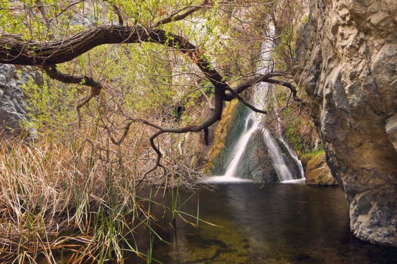
You’ll need to drive on a curvy dirt road to access the trailhead, so it’s not suitable for RVs and trailers.
Insider Tip: You will have to hike across small streams and scramble around rocks. Make sure you’ve packed extra clothes, shoes, and a first aid kit in case of accidents.
10. Natural Bridge Trail
Distance: 1.4 miles
Type of Trail: Out & Back
Elevation Gain: 449 ft
Time Spent: 1 hour
The Natural Bridge is an arch made out of rock and gravel, and it’s 35 feet high and wide. The trail to the Natural Bridge isn’t paved, and you have to walk on gravel to get there. Hike in the morning for more shade from the canyon walls on the trail.
Insider Tip: Hike past the Natural Bridge to see hanging canyons and a dry waterfall.
11. Mesquite Flat Sand Dunes Trail
Distance: 2.8 miles
Type of Trail: Out & Back
Elevation Gain: 206 ft
Time Spent: 1 hour 45 minutes
Hike up the tallest dune at the Mesquite Flat Sand Dunes. These dunes are named after the mesquite trees that grow on the dunes. The dunes can reach as high as 100 feet.
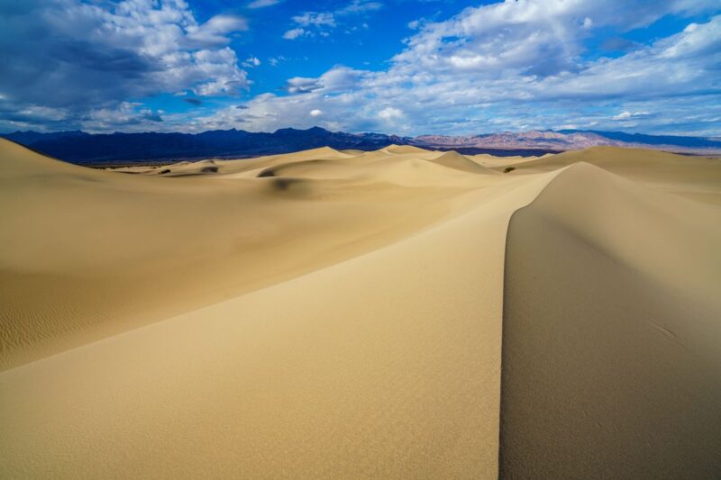
Insider Tip: The Mesquite Flat Sand Dunes is one of the few dunes in Death Valley National Park that you can sandboard.
Challenging Hikes in Death Valley National Park
12. Complete Circuit Trail
Distance: 7.8 miles
Type of Trail: Loop
Elevation Gain: 834 ft
Time Spent: 5 hours
Try this strenuous hike if you love hiking through canyons and badlands. Start at Zabriskie Point and hike towards Manly Beacon and the Red Cathedral area. Then continue to Golden Canyon and loop back on the Gower Gulch Trail. For more information on this trail, check out the National Parks Service site.

Insider Tip: For a day of solitude at this popular park, choose to do the Complete Circuit Trail. Picnic at the Red Cathedral area and look up at the reddish-brown canyon walls like organ pipes.
13. Telescope Peak Trail
Distance: 14 miles
Type of Trail: Out & Back
Elevation Gain: 3,000 ft
Time Spent: 7 hours
Telescope Peak sits at 11,049 feet above sea level. At the top, look down at the Badwater Basin salt flats on one side and the Panamint Valley on the other side.
Insider Tip: Bring your binoculars. If it’s a clear day, you can see Mount Whitney, the highest point in the lower 48 US states.
Things To Know Before Hiking in Death Valley National Park
- Like Joshua Tree National Park, this desert park is not recommended to visit during the summer. Temperatures have gone up to 134 Fahrenheit at this park!
- Cell phone service is very limited in Death Valley National Park. Once you pay the entrance fee or show your annual pass, you can grab a Death Valley National Park map at the Furnace Creek Visitor Center. Download Google Maps and Maps.Me for offline use.
- Beware of desert animals. Watch where you place your hands and feet before actually placing them.
- Even during the winter season, the air can be dry with sunny weather, so plan to drink and carry adequate water when hiking.
Death Valley is world-famous for the diverse and spectacular views from its desert landscape. This park has it all, from colorful badlands and salt flats to canyons and vista points. Add these incredible hikes in Death Valley National Park to your list when you plan your trip to this park!
More USA National Parks
>>> BIO
Rasika is the owner of the travel blog Bae Area and Beyond. She is from the Bay Area, and her blog covers California destinations. She hopes that her readers will fall in love with California, just like she did.
TAKE THE SHORTCUT
Want to know how to live abroad without being rich?!
Get my shortcut! It's THE ONLY guide you'll need on how to sustain a life abroad—NO BS!
GIVE IT TO ME 😍